MyTopo
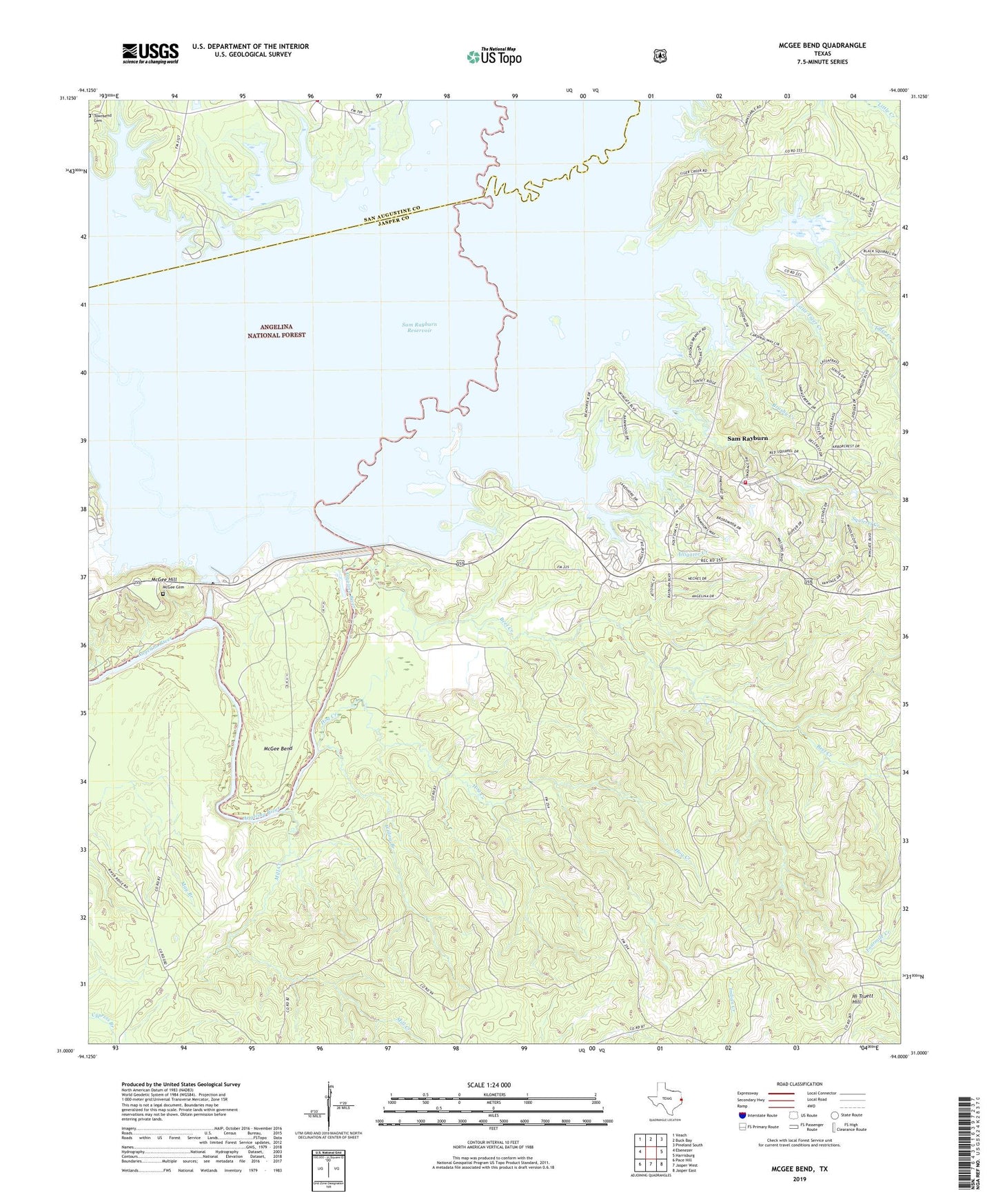
McGee Bend Texas US Topo Map
Couldn't load pickup availability
2019 topographic map quadrangle McGee Bend in the state of Texas. Scale: 1:24000. Based on the newly updated USGS 7.5' US Topo map series, this map is in the following counties: Jasper, San Augustine. The map contains contour data, water features, and other items you are used to seeing on USGS maps, but also has updated roads and other features. This is the next generation of topographic maps. Printed on high-quality waterproof paper with UV fade-resistant inks.
Quads adjacent to this one:
West: Ebenezer
Northwest: Veach
North: Buck Bay
Northeast: Pineland South
East: Harrisburg
Southeast: Jasper East
South: Jasper West
Southwest: Pace Hill
Contains the following named places: Alligator Creek, Bear Creek, Beef Creek, Big Branch, Brushy Creek, Drake Springs Branch, Ebenezer Park Campground, Hi Truett Hill, Hog Creek, Jasper County Constable's Office Precinct 5, KJAS-FM (Jasper), Lake Rayburn Fire Department, Letney Cemetery, Little Tiger Creek, McGee Bend, McGee Cemetery, McGee Hill, Meadows Branch, Mill Creek, Powell, Powell Branch, Powell Park Campground, Rayburn Park Campground, Sam Rayburn, Sam Rayburn Census Designated Place, Sam Rayburn Dam, Squirrel Creek, Tiger Creek, Townsend Cemetery, Twin Dikes Park, Twin Dikes Park Campground, Willow Branch, ZIP Code: 75931