MyTopo
McQueeney Texas US Topo Map
Couldn't load pickup availability
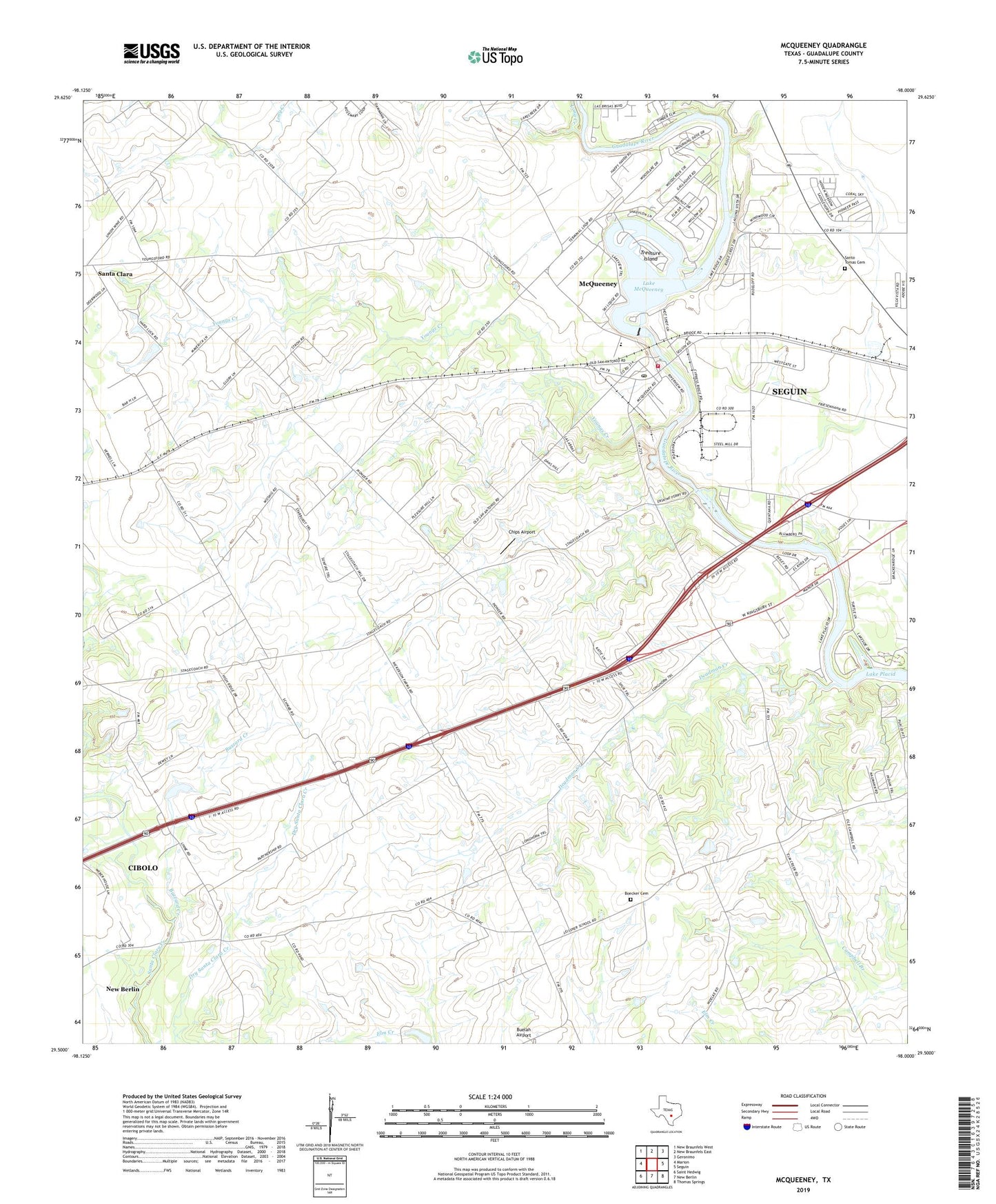
2019 topographic map quadrangle McQueeney in the state of Texas. Scale: 1:24000. Based on the newly updated USGS 7.5' US Topo map series, this map is in the following counties: Guadalupe. The map contains contour data, water features, and other items you are used to seeing on USGS maps, but also has updated roads and other features. This is the next generation of topographic maps. Printed on high-quality waterproof paper with UV fade-resistant inks.
Quads adjacent to this one:
West: Marion
Northwest: New Braunfels West
North: New Braunfels East
Northeast: Geronimo
East: Seguin
Southeast: Thomas Springs
South: New Berlin
Southwest: Saint Hedwig
Contains the following named places: Boecker Cemetery, Buzzard Creek, Chips Airport, Deadman Creek, Garys Airport, Guadalupe County Constable's Office Precinct 4, Guadalupe-Blanco River Authority Tp-3 Dam, Hilda Siding, Lake Breeze Ski Lodge, Lake McQueeney, Lake Placid, Long Creek, McQueeney, McQueeney Census Designated Place, McQueeney Elementary School, McQueeney Post Office, McQueeney Volunteer Fire Department, Morrison Falls, Muehlsville, New Salem Baptist Church, Nolte, Saints Strip, Santa Clara, Santa Clara Church, Santo Tomas Cemetery, Treasure Island, WOAI-AM (San Antonio), Youngs Creek, Zipp, ZIP Code: 78123