
MyTopo
Middle Water Texas US Topo Map
Couldn't load pickup availability
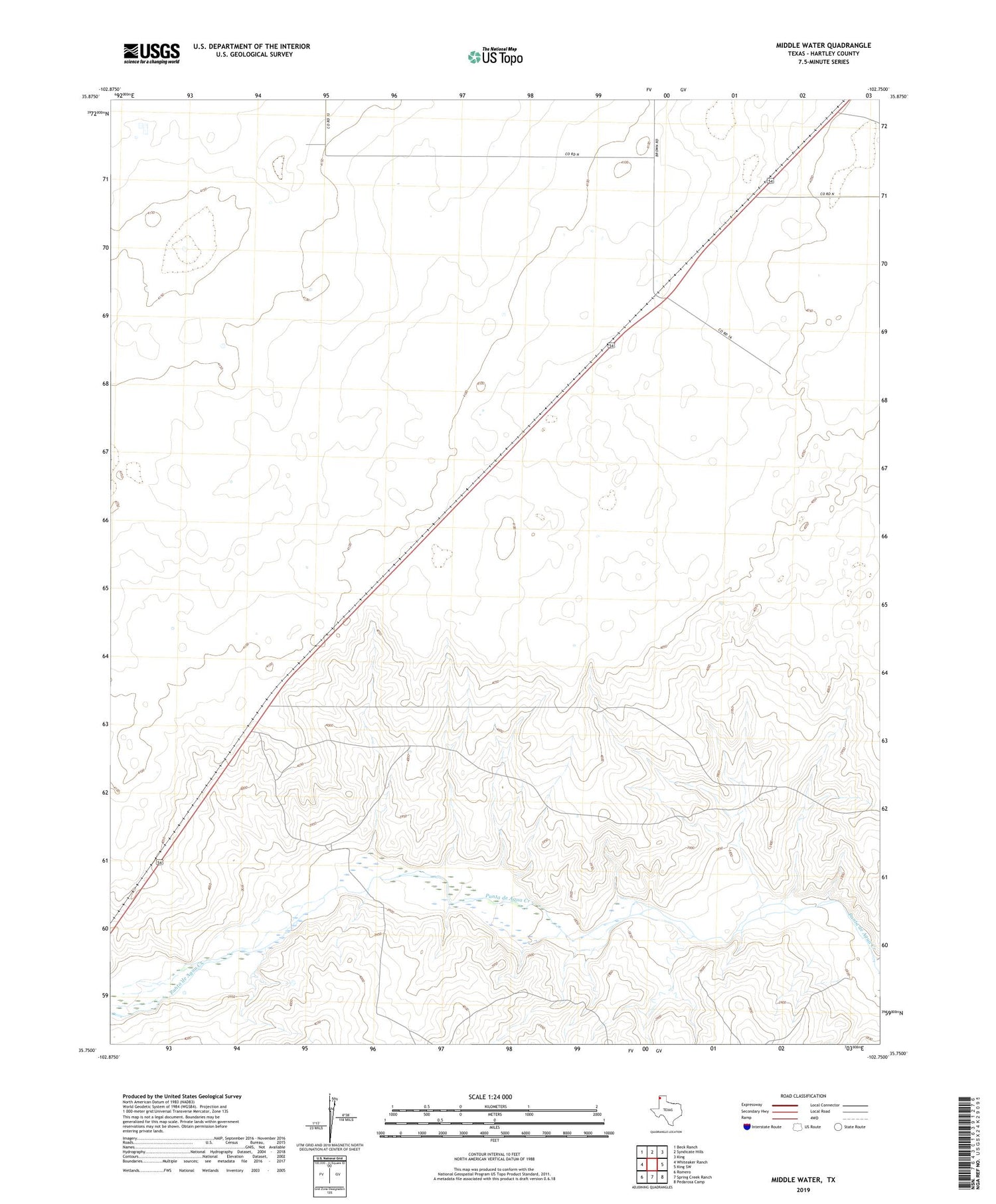
2019 topographic map quadrangle Middle Water in the state of Texas. Scale: 1:24000. Based on the newly updated USGS 7.5' US Topo map series, this map is in the following counties: Hartley. The map contains contour data, water features, and other items you are used to seeing on USGS maps, but also has updated roads and other features. This is the next generation of topographic maps. Printed on high-quality waterproof paper with UV fade-resistant inks.
Quads adjacent to this one:
West: Whiteaker Ranch
Northwest: Beck Ranch
North: Syndicate Hills
Northeast: King
East: King SW
Southeast: Pedarosa Camp
South: Spring Creek Ranch
Southwest: Romero
Contains the following named places: Center Well, Dammier Ranch, House Well, Middle Water, Middle Wells, Mission San Francisco De La Espada, Red Windmill, Salthouse Well, Sand Well, South Sand Well, Steel Windmill, Taylor Ranch, Trap Well


