MyTopo
Spring Creek Ranch Texas US Topo Map
Couldn't load pickup availability
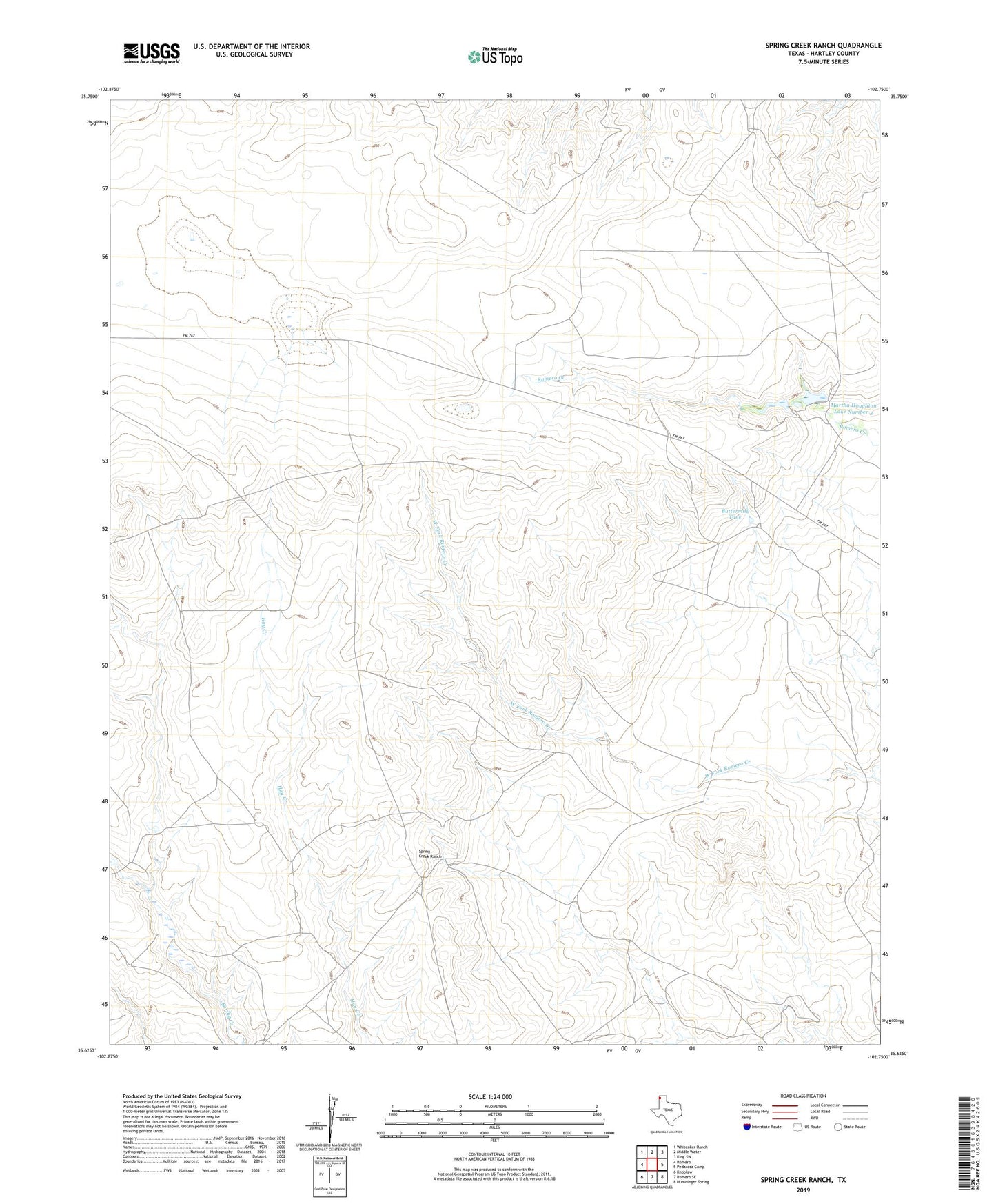
2022 topographic map quadrangle Spring Creek Ranch in the state of Texas. Scale: 1:24000. Based on the newly updated USGS 7.5' US Topo map series, this map is in the following counties: Hartley. The map contains contour data, water features, and other items you are used to seeing on USGS maps, but also has updated roads and other features. This is the next generation of topographic maps. Printed on high-quality waterproof paper with UV fade-resistant inks.
Quads adjacent to this one:
West: Romero
Northwest: Whiteaker Ranch
North: Middle Water
Northeast: King SW
East: Pedarosa Camp
Southeast: Humdinger Spring
South: Romero SE
Southwest: Knoblaw
This map covers the same area as the classic USGS quad with code o35102f7.
Contains the following named places: Antelope Windmill, Buttermilk Tank, Channing Division, East Windmill, Hanbury Windmill, Houghton Ranch, Little Nelson Windmill, Martha Houghton Lake Number 3, Martha Houghton Lake Number 3 Dam, Martha Houghton Lake Number 4, Martha Houghton Lake Number 4 Dam, South Center Windmill, Southeast Windmill, Spring Creek Ranch, Top East Windmill, West Fork Romero Creek