
MyTopo
Mitre Peak Texas US Topo Map
Couldn't load pickup availability
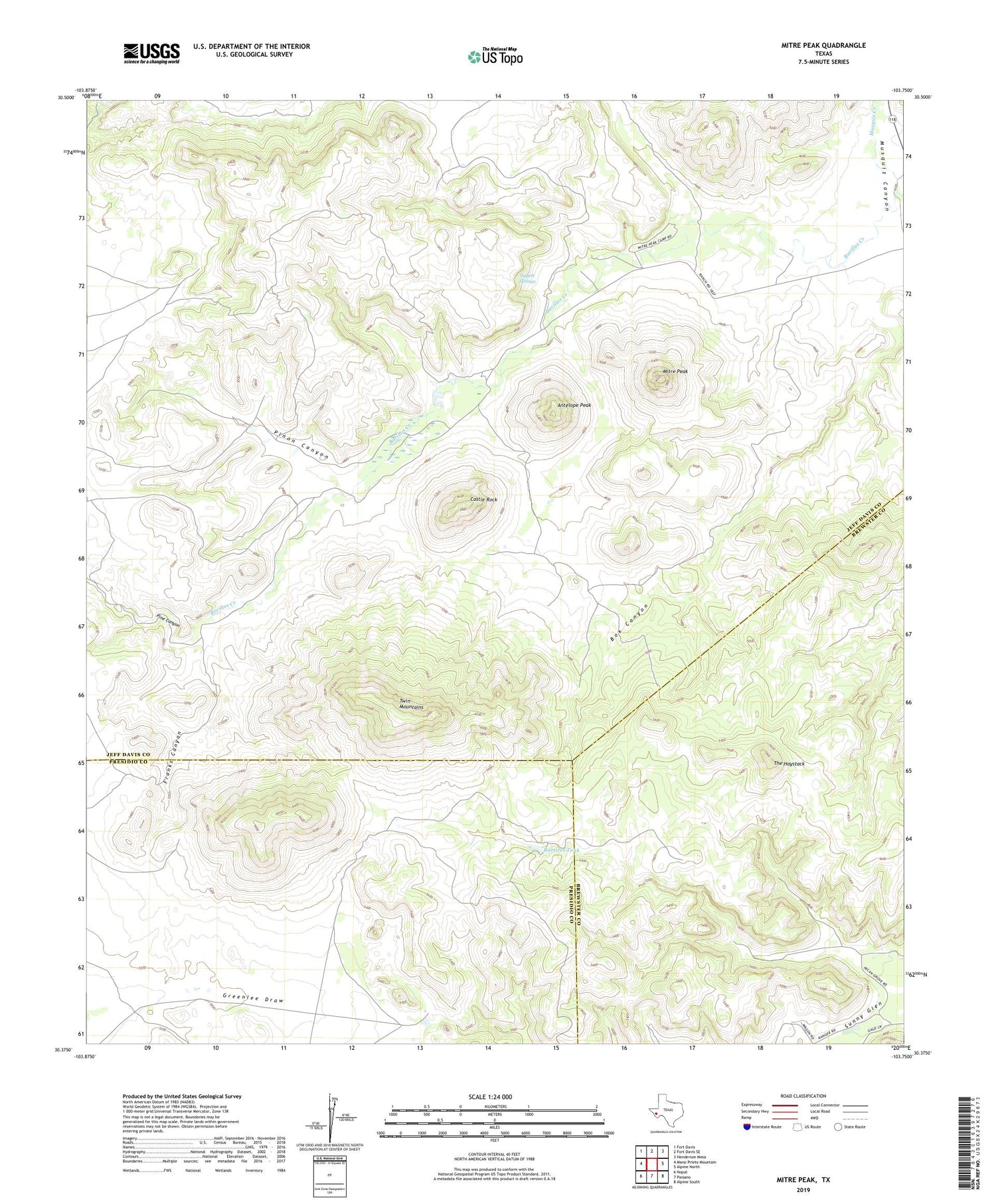
2019 topographic map quadrangle Mitre Peak in the state of Texas. Scale: 1:24000. Based on the newly updated USGS 7.5' US Topo map series, this map is in the following counties: Jeff Davis, Presidio, Brewster. The map contains contour data, water features, and other items you are used to seeing on USGS maps, but also has updated roads and other features. This is the next generation of topographic maps. Printed on high-quality waterproof paper with UV fade-resistant inks.
Quads adjacent to this one:
West: Mano Prieto Mountain
Northwest: Fort Davis
North: Fort Davis SE
Northeast: Henderson Mesa
East: Alpine North
Southeast: Alpine South
South: Paisano
Southwest: Nopal
Contains the following named places: Antelope Peak, Barillos Creek, Box Canyon, Castle Rock, Copeland Tank, Franks Canyon, Mitre Peak, Mitre Peak Camp, Pine Canyon, Pinon Canyon, Ramirez Tank, Sunny Glen, The Haystack, Tippett Springs, Twin Mountains


