MyTopo
Fort Davis Texas US Topo Map
Couldn't load pickup availability
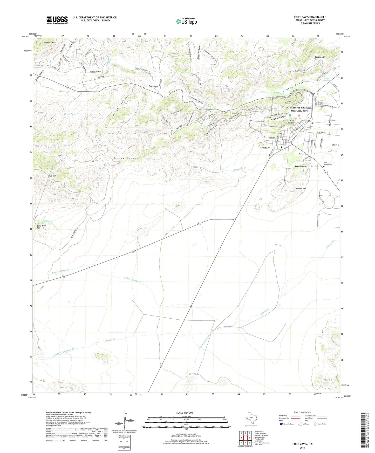
2022 topographic map quadrangle Fort Davis in the state of Texas. Scale: 1:24000. Based on the newly updated USGS 7.5' US Topo map series, this map is in the following counties: Jeff Davis. The map contains contour data, water features, and other items you are used to seeing on USGS maps, but also has updated roads and other features. This is the next generation of topographic maps. Printed on high-quality waterproof paper with UV fade-resistant inks.
Quads adjacent to this one:
West: Blue Mountain
Northwest: Mount Locke
North: Casket Mountain
Northeast: Swayback Mountain
East: Fort Davis SE
Southeast: Mitre Peak
South: Mano Prieto Mountain
Southwest: Smith Hills
This map covers the same area as the classic USGS quad with code o30103e8.
Contains the following named places: Arabella Mountain, Blue Mountain Airport, Brushy Canyon, Davis Mountains State Park, Davis Mountains State Park Trail, Devils Tank, Dirks - Anderson Elementary School, Dolores Mountain, Fort Davis, Fort Davis Cemetery, Fort Davis Census Designated Place, Fort Davis National Historic Site, Fort Davis Post Office, Fort Davis Schools, Fort Davis Spring, Fort Davis Volunteer Fire Department, Grierson-Sproul House, Henry M and Annie V Trueheart House, Hospital Canyon, Jeff Davis County Ambulance, Jeff Davis County Sheriff's Office, Keesey Canyon, Lone Tree Creek, Lone Tree Hill, Middle Fork Cienega Creek, North Fork Cienega Creek, Olds Creek, Pioneer Cemetery, Road Canyon, Rough Canyon, Saint Joseph Cemetery, Scobee Mountain, Sleeping Lion Mountain, South Fork Cienega Creek, Sproul Reservoir, Tall Grassland Trail, Texas Department of Public Safety Highway Patrol Office