MyTopo
Monroe City Texas US Topo Map
Couldn't load pickup availability
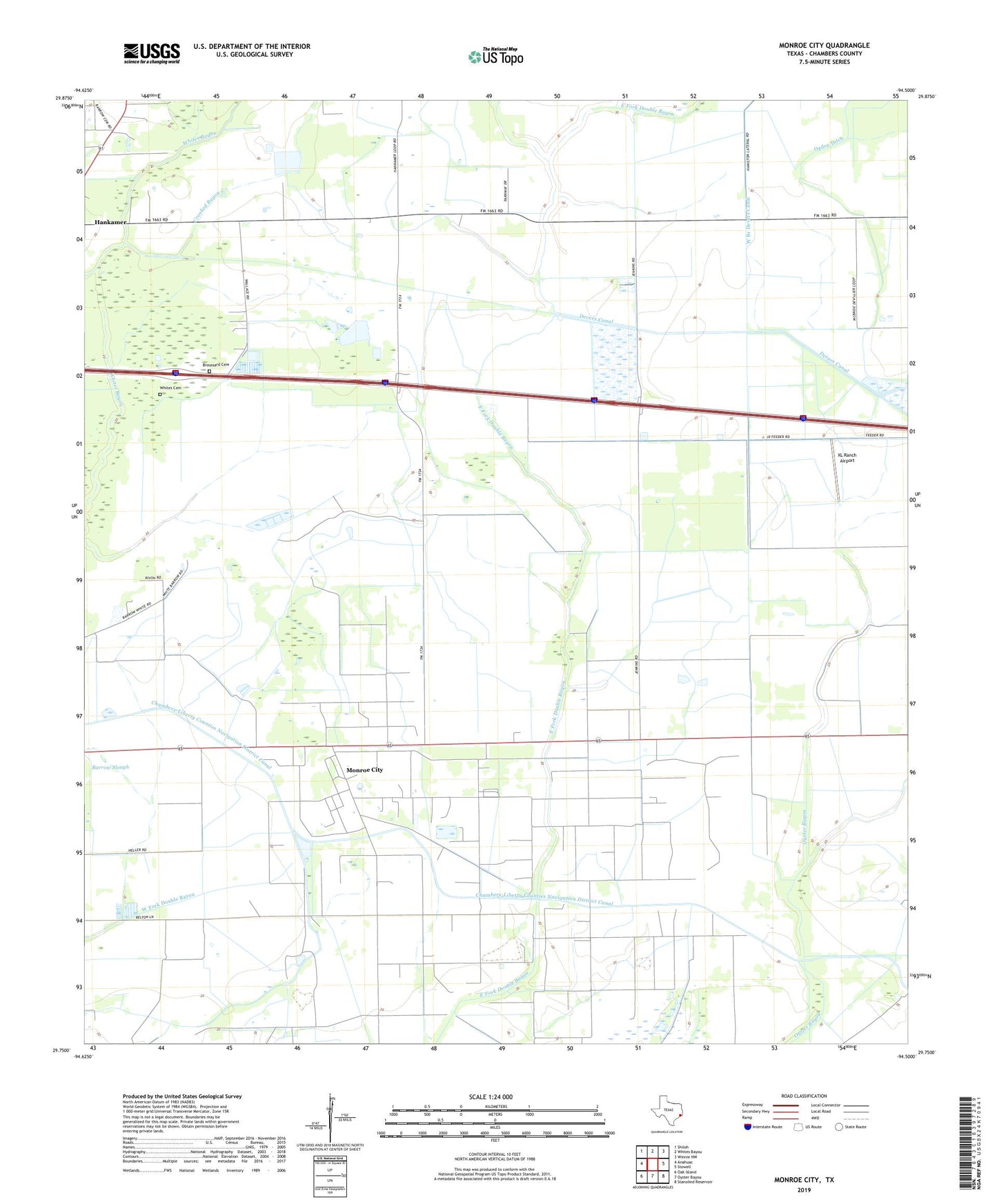
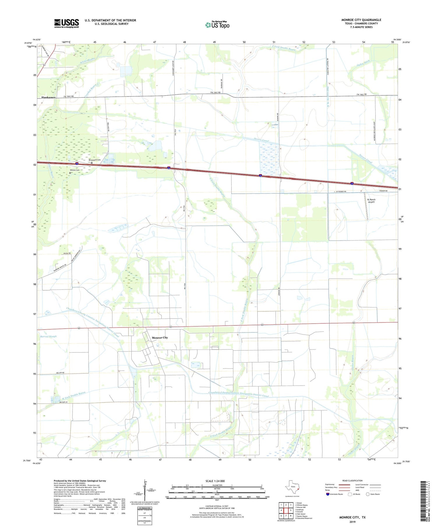
2019 topographic map quadrangle Monroe City in the state of Texas. Scale: 1:24000. Based on the newly updated USGS 7.5' US Topo map series, this map is in the following counties: Chambers. The map contains contour data, water features, and other items you are used to seeing on USGS maps, but also has updated roads and other features. This is the next generation of topographic maps. Printed on high-quality waterproof paper with UV fade-resistant inks.
Quads adjacent to this one:
West: Anahuac
Northwest: Shiloh
North: Whites Bayou
Northeast: Winnie NW
East: Stowell
Southeast: Stanolind Reservoir
South: Oyster Bayou
Southwest: Oak Island
Contains the following named places: Anahuac Oil Field, Broussard Cemetery, Chambers-Liberty Counties Navigation District Canal, Crooked Bayou, Devers Canal, Monroe City, Whites Cemetery, XL Ranch Airport, ZIP Code: 77560