MyTopo
Monte Christo Texas US Topo Map
Couldn't load pickup availability
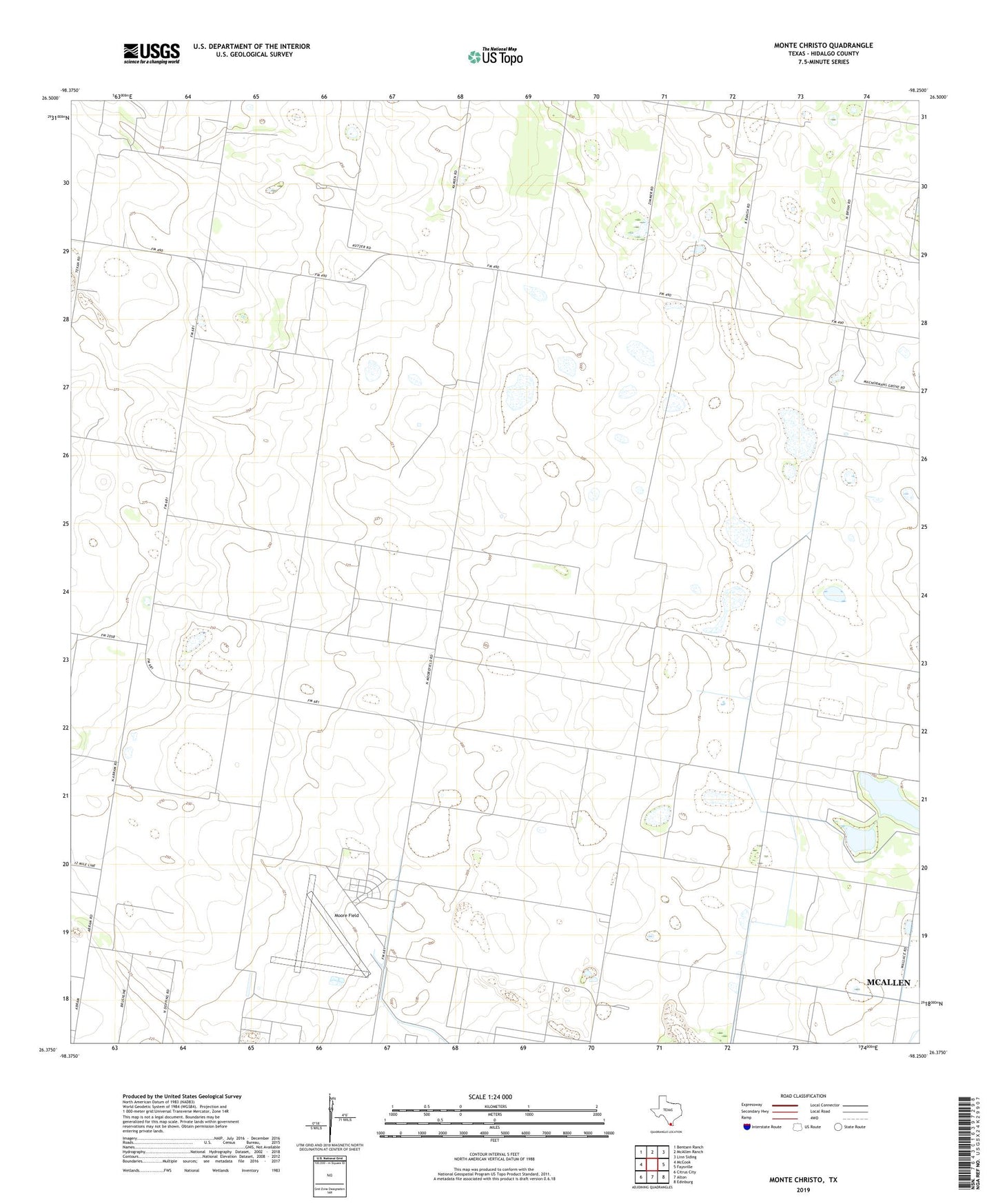
2019 topographic map quadrangle Monte Christo in the state of Texas. Scale: 1:24000. Based on the newly updated USGS 7.5' US Topo map series, this map is in the following counties: Hidalgo. The map contains contour data, water features, and other items you are used to seeing on USGS maps, but also has updated roads and other features. This is the next generation of topographic maps. Printed on high-quality waterproof paper with UV fade-resistant inks.
Quads adjacent to this one:
West: McCook
Northwest: Bentsen Ranch
North: McAllen Ranch
Northeast: Linn Siding
East: Faysville
Southeast: Edinburg
South: Alton
Southwest: Citrus City
Contains the following named places: El Golfo Windmill, La Gloria Ranch, La Trenca Windmill, Monte Christo, Monte Christo Gas Field, Moore Air Force Base, Moore Field, ZIP Code: 78541