MyTopo
Linn Siding Texas US Topo Map
Couldn't load pickup availability
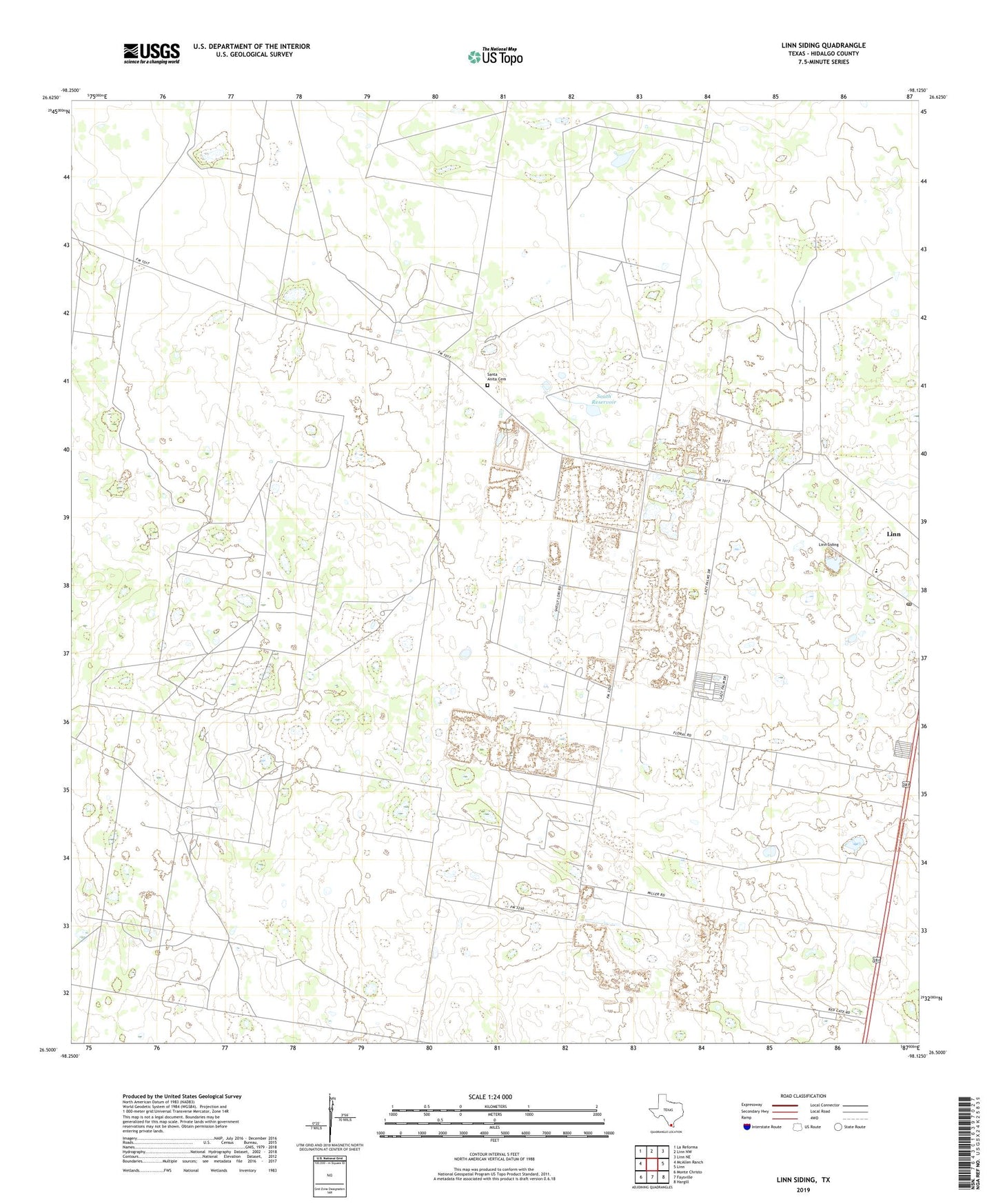
2022 topographic map quadrangle Linn Siding in the state of Texas. Scale: 1:24000. Based on the newly updated USGS 7.5' US Topo map series, this map is in the following counties: Hidalgo. The map contains contour data, water features, and other items you are used to seeing on USGS maps, but also has updated roads and other features. This is the next generation of topographic maps. Printed on high-quality waterproof paper with UV fade-resistant inks.
Quads adjacent to this one:
West: McAllen Ranch
Northwest: La Reforma
North: Linn NW
Northeast: Linn NE
East: Linn
Southeast: Hargill
South: Faysville
Southwest: Monte Christo
This map covers the same area as the classic USGS quad with code o26098e2.
Contains the following named places: Agua Salado Windmill, Brahma Windmill, Brewster Elementary School, Brewster School, Buenos Aires Windmill, Casa Blanca Ranch, Damion Windmill, El Desierto Ranch, El Perdido Windmill, El Rebaje Windmill, La Cadena Windmill, La Conejo Windmill, La Esperanza Windmill, La Jamaica Windmill, La Rosita Windmill, Labor del Llano Windmill, Lane Number 1 Colonia, Lane Number 2 Colonia, Linn Census Designated Place, Linn Post Office, Linn Siding, Little Windmill, Los Angeles, Nino Jesus de Praga Church, Puerto Rico-San Manuel Division, Red Windmill, Santa Anita Cemetery, Santa Anita Ranch, Santa Clara Windmill, Santillana Gas Field, Santillana Windmill, Santo Domingo Windmill, South Reservoir, Tijerina Ranch