
MyTopo
Moss Bluff Texas US Topo Map
Couldn't load pickup availability
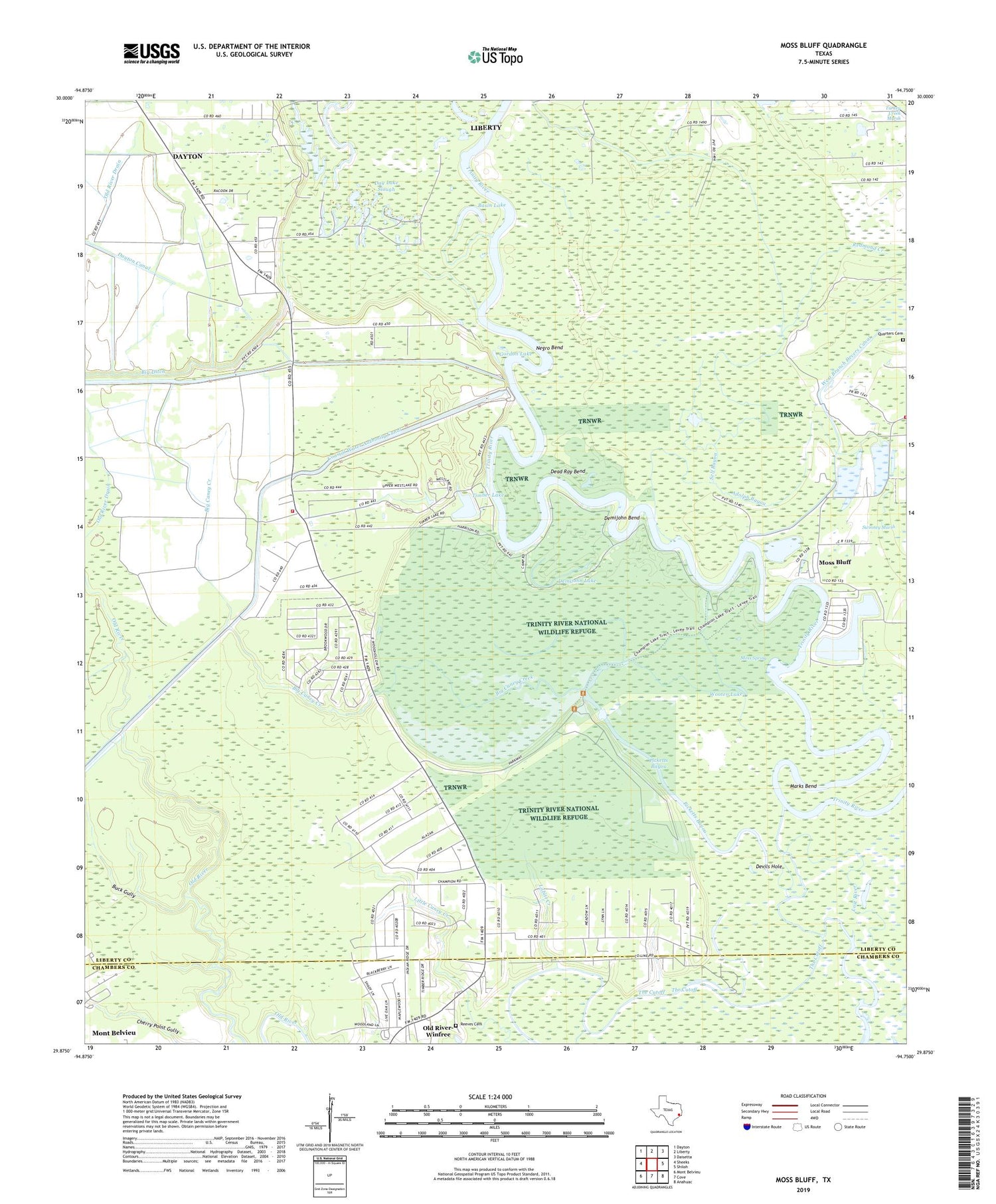
2019 topographic map quadrangle Moss Bluff in the state of Texas. Scale: 1:24000. Based on the newly updated USGS 7.5' US Topo map series, this map is in the following counties: Liberty, Chambers. The map contains contour data, water features, and other items you are used to seeing on USGS maps, but also has updated roads and other features. This is the next generation of topographic maps. Printed on high-quality waterproof paper with UV fade-resistant inks.
Quads adjacent to this one:
West: Sheeks
Northwest: Dayton
North: Liberty
Northeast: Daisetta
East: Shiloh
Southeast: Anahuac
South: Cove
Southwest: Mont Belvieu
Contains the following named places: Adolph Bayou, Basin Lake, Big Caney Creek, Boggy Lake, Buck Gully, Coastal Water Authority Canal, Day Lake Slough, Dead Ray Bend, Demijohn Bend, Demijohn Lake, Devils Hole, Duck Lake, George Ruby Bend, Gordon Lake, Howard Lake, Labitt Creek, Lease Lake, Lynchburg Canal, Marks Bend, Moore Bluff Pumping Station, Moss Bluff, Moss Bluff Volunteer Fire Department Station 2, Moss Spring, Old River Community, Picketts Bayou, Quarters Cemetery, Redmond Creek, Reeves Cemetery, Self Bayou, South Dayton, South Dayton Church, Stub Lake, Talley Lake, The Cut Off, The Cutoff, Timber Lake, Timber Lake Estates, Westlake Community Volunteer Fire Department, Winfree Church, Wooten Lake


