MyTopo
Muldoon Texas US Topo Map
Couldn't load pickup availability
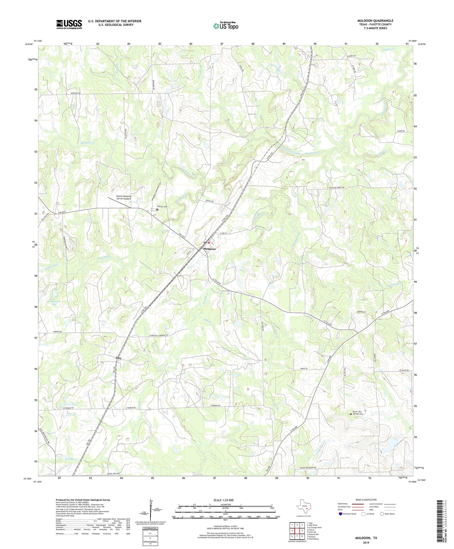
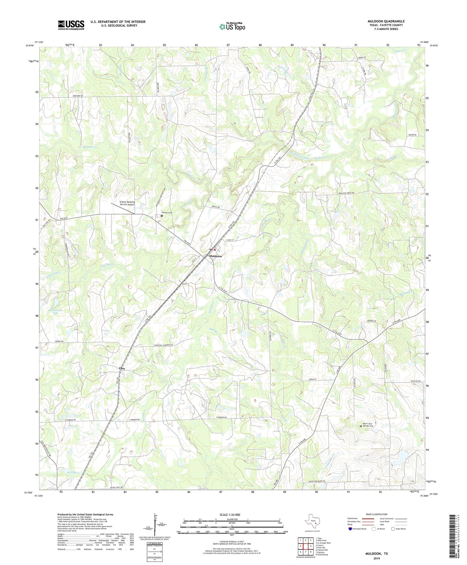
2019 topographic map quadrangle Muldoon in the state of Texas. Scale: 1:24000. Based on the newly updated USGS 7.5' US Topo map series, this map is in the following counties: Fayette. The map contains contour data, water features, and other items you are used to seeing on USGS maps, but also has updated roads and other features. This is the next generation of topographic maps. Printed on high-quality waterproof paper with UV fade-resistant inks.
Quads adjacent to this one:
West: Cistern
Northwest: Togo
North: West Point
Northeast: La Grange West
East: Swiss Alp
Southeast: Schulenburg
South: Flatonia
Southwest: Flatonia NW
Contains the following named places: Black Jack Springs Cemetery, Blackjack Creek, Busby Branch, Cedar Creek, Chandler Branch, Cherry Spraying Service Airport, Dogwood Creek, Flatonia Division, Floy, Grand Prairie Memorial Library, Haw Branch, Jack Young Creek, Live Oak Creek, Marly, Muldoon, Muldoon Oil Field, Muldoon Post Office, Muldoon Volunteer Fire Department, Pin Oak Creek, Pitman Cemetery, Salt Branch, Steinhauser Lake, Steinhauser Lake Dam, Tuttle Creek, ZIP Code: 78949