MyTopo
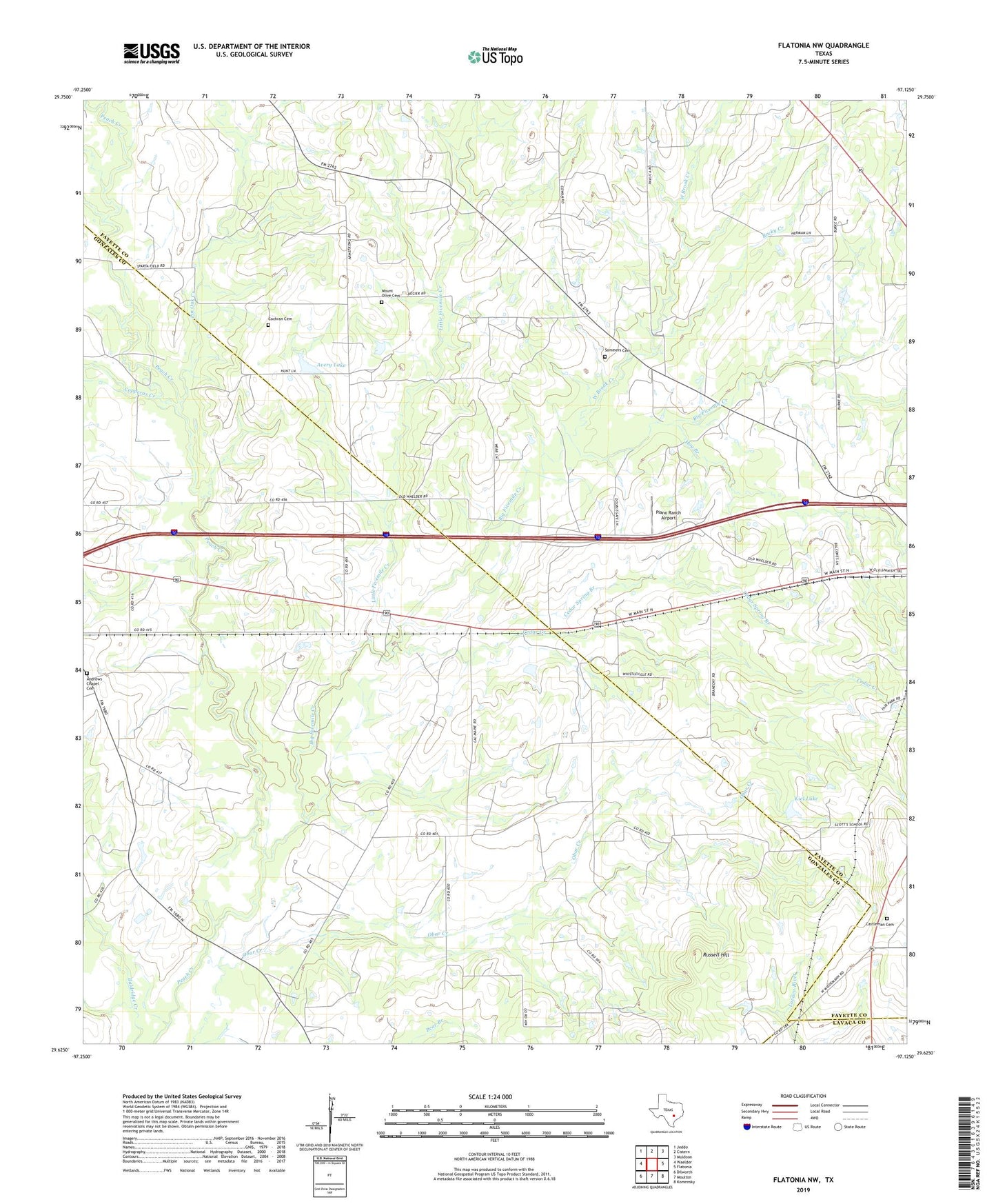
Flatonia NW Texas US Topo Map
Couldn't load pickup availability
2022 topographic map quadrangle Flatonia NW in the state of Texas. Scale: 1:24000. Based on the newly updated USGS 7.5' US Topo map series, this map is in the following counties: Fayette, Gonzales, Lavaca. The map contains contour data, water features, and other items you are used to seeing on USGS maps, but also has updated roads and other features. This is the next generation of topographic maps. Printed on high-quality waterproof paper with UV fade-resistant inks.
Quads adjacent to this one:
West: Waelder
Northwest: Jeddo
North: Cistern
Northeast: Muldoon
East: Flatonia
Southeast: Komensky
South: Moulton
Southwest: Dilworth
This map covers the same area as the classic USGS quad with code o29097f2.
Contains the following named places: Andrews Chapel Cemetery, Armstrong, Avery Lake, Avery Lake Dam, Big Fivemile Creek, Castleman Cemetery, Cedar Creek, Cedar Spring Branch, Cochran Cemetery, Cooke County Library, Copperas Creek, Elm Creek, Hog Branch, Kiel Lake, Kiel Lake Dam, Little Fivemile Creek, Mount Olive Cemetery, Newtonville, Piano Ranch Airport, Pin Oak Creek, Rocky Creek, Russell Hill, Sommers Cemetery, West Brook Creek, ZIP Code: 78941