MyTopo
Nido Ranch Texas US Topo Map
Couldn't load pickup availability
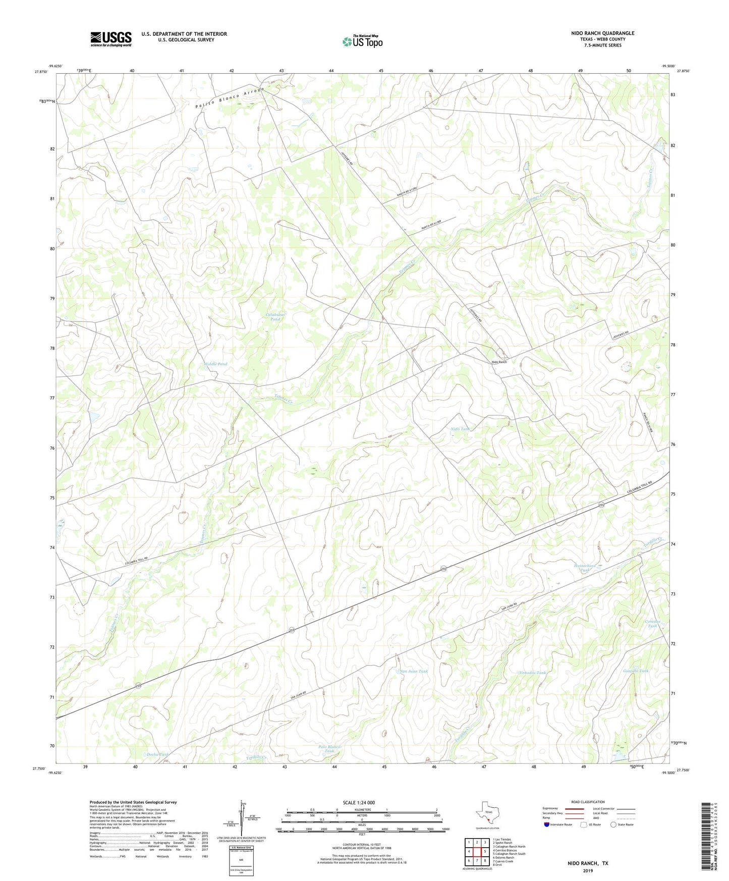
2019 topographic map quadrangle Nido Ranch in the state of Texas. Scale: 1:24000. Based on the newly updated USGS 7.5' US Topo map series, this map is in the following counties: Webb. The map contains contour data, water features, and other items you are used to seeing on USGS maps, but also has updated roads and other features. This is the next generation of topographic maps. Printed on high-quality waterproof paper with UV fade-resistant inks.
Quads adjacent to this one:
West: Cerritos Blancos
Northwest: Las Tiendas
North: Spohn Ranch
Northeast: Callaghan Ranch North
East: Callaghan Ranch South
Southeast: Orvil
South: Cuervo Creek
Southwest: Dolores Ranch
Contains the following named places: Altos Windmill, Calabazas Pond, Comitas Tank, Del Alto Windmill, Docha Tank, El Laredo Windmill, El Llano Windmill, El Siete Windmill, El Trevino Windmill, Fresno Ranch, Guajillo Tank, Huisachosa Tank, Huisachosa Windmill, Middle Pond, Nido Ranch, Nido Tank, Nido Windmill, Palo Blanco Tank, Pratt Windmill, Rea Well, San Juan Ranch, San Juan Tank, South Windmill, Tordillo Windmill, Tule Windmill, Venados Tank