MyTopo
Las Tiendas Texas US Topo Map
Couldn't load pickup availability
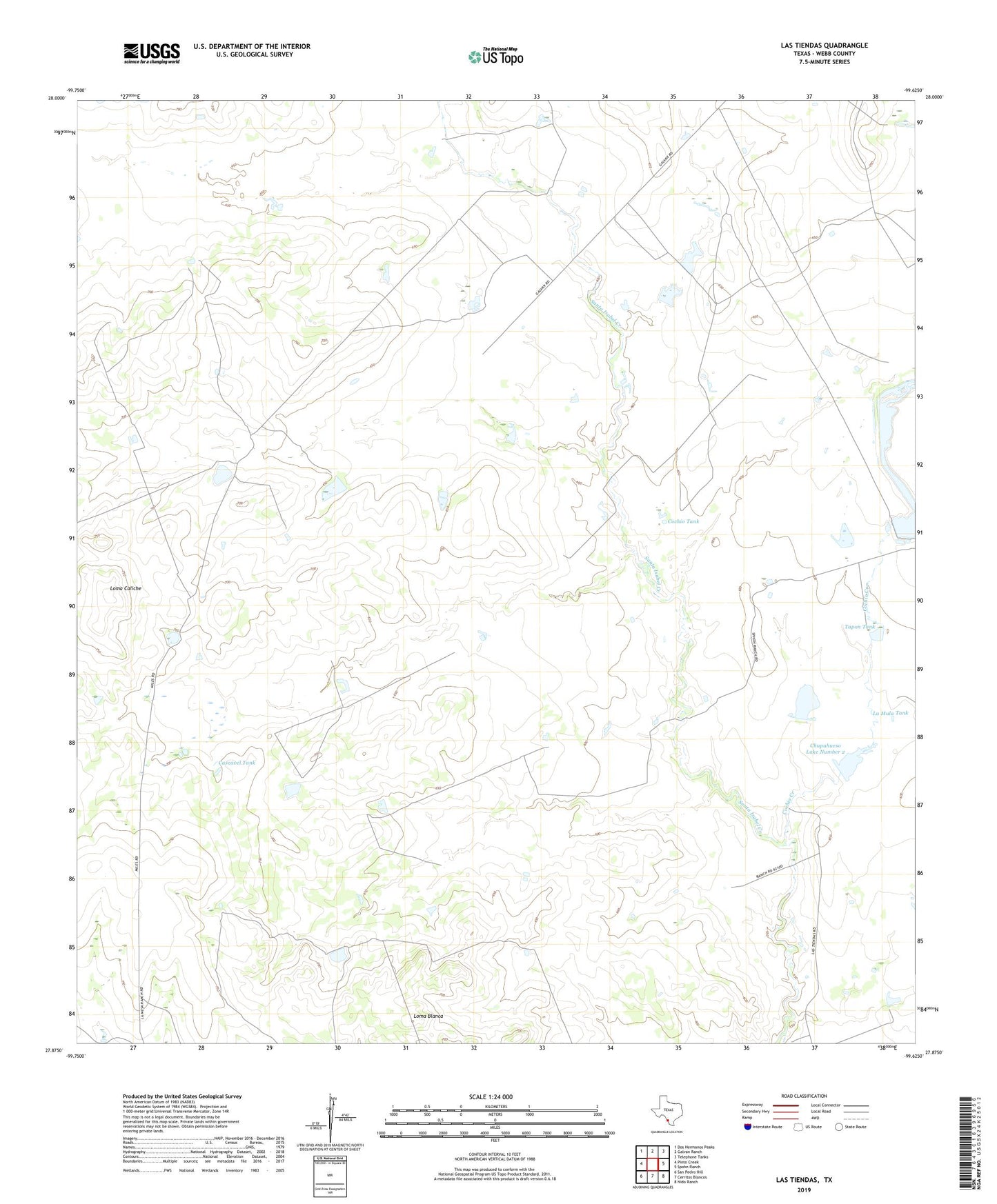
2022 topographic map quadrangle Las Tiendas in the state of Texas. Scale: 1:24000. Based on the newly updated USGS 7.5' US Topo map series, this map is in the following counties: Webb. The map contains contour data, water features, and other items you are used to seeing on USGS maps, but also has updated roads and other features. This is the next generation of topographic maps. Printed on high-quality waterproof paper with UV fade-resistant inks.
Quads adjacent to this one:
West: Pinto Creek
Northwest: Dos Hermanos Peaks
North: Galvan Ranch
Northeast: Telephone Tanks
East: Spohn Ranch
Southeast: Nido Ranch
South: Cerritos Blancos
Southwest: San Pedro Hill
This map covers the same area as the classic USGS quad with code o27099h6.
Contains the following named places: Cascavel Tank, Chupahueso Lake Number 1 Dam, Chupahueso Lake Number 2, Chupahueso Lake Number 2 Dam, Cochio Creek, Cochio Tank, Fuller Ranch, Hearne Ranch, Jefferies Tank, La Mula Tank, Las Tiendas, Loma Blanca, Loma Caliche, Spohn Ranch Lake, Spohn Ranch Lake Dam, Tapon Tank