MyTopo
Callaghan Ranch North Texas US Topo Map
Couldn't load pickup availability
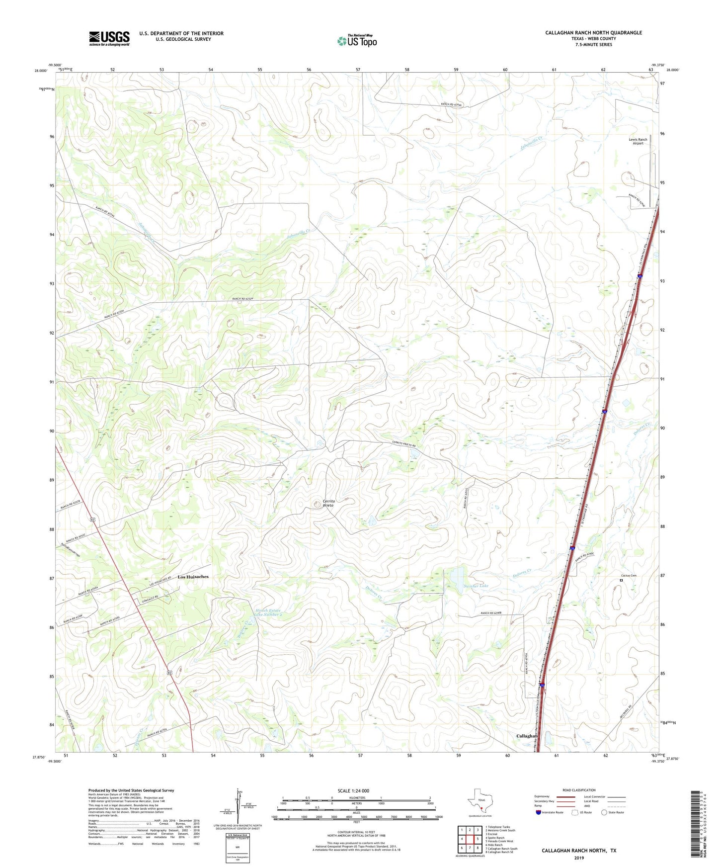
2022 topographic map quadrangle Callaghan Ranch North in the state of Texas. Scale: 1:24000. Based on the newly updated USGS 7.5' US Topo map series, this map is in the following counties: Webb. The map contains contour data, water features, and other items you are used to seeing on USGS maps, but also has updated roads and other features. This is the next generation of topographic maps. Printed on high-quality waterproof paper with UV fade-resistant inks.
Quads adjacent to this one:
West: Spohn Ranch
Northwest: Telephone Tanks
North: Mesteno Creek South
Northeast: Encinal
East: Venado Creek West
Southeast: Callaghan Ranch SE
South: Callaghan Ranch South
Southwest: Nido Ranch
This map covers the same area as the classic USGS quad with code o27099h4.
Contains the following named places: Cactus, Cactus Cemetery, Callaghan, Callaghan Ranch Airport, Cerrito Prieto, Hirsch Estate Lake Number 2, Hirsch Estate Lake Number 2 Dam, Laredo North-Webb Division, Lewis Ranch Airport, Los Huisaches Census Designated Place, Los Huisaches Colonia, Los Huisaches Number 2 Colonia, San Ramon, San Ramon Ranch, Swisher Lake, Swisher Lake Dam