MyTopo
Nix Texas US Topo Map
Couldn't load pickup availability
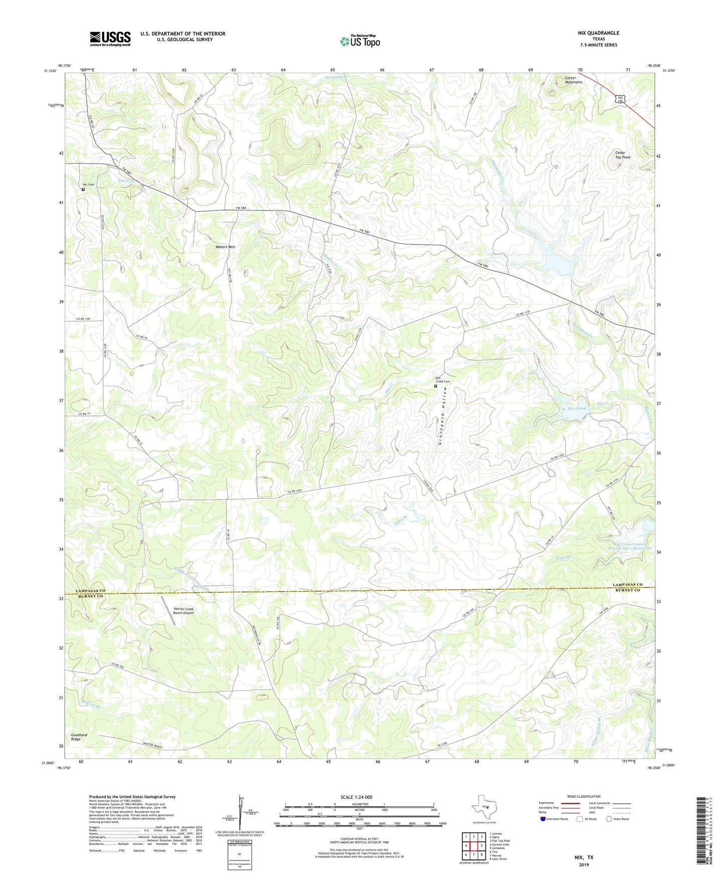
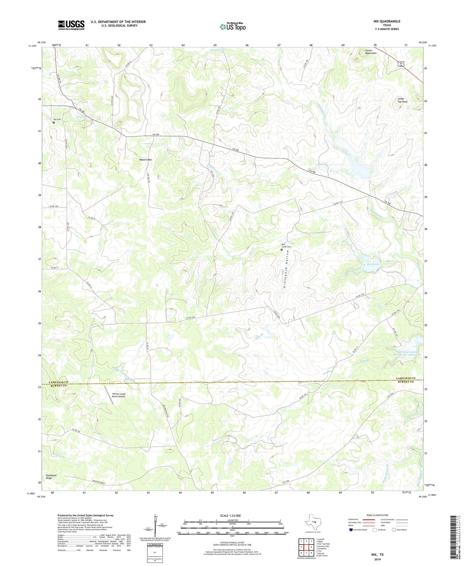
2019 topographic map quadrangle Nix in the state of Texas. Scale: 1:24000. Based on the newly updated USGS 7.5' US Topo map series, this map is in the following counties: Lampasas, Burnet. The map contains contour data, water features, and other items you are used to seeing on USGS maps, but also has updated roads and other features. This is the next generation of topographic maps. Printed on high-quality waterproof paper with UV fade-resistant inks.
Quads adjacent to this one:
West: Gorman Falls
Northwest: Lometa
North: Ogles
Northeast: Flat Top Peak
East: Lampasas
Southeast: Lake Victor
South: Naruna
Southwest: Tow
Contains the following named places: Carter Mountains, Cedar Top Peak, Donalson Creek, Graveyard Hollow, Hughes Creek, McCreaville Church, Nix, Nix Cemetery, Pecan Spring Branch, Pitt Creek, Pitt Creek Cemetery, Reservoir Number One, Reservoir Number Three, Reservoir Number Two, Soil Conservation Service Site 1 Dam, Soil Conservation Service Site 1 Reservoir, Soil Conservation Service Site 2 Dam, Soil Conservation Service Site 2 Reservoir, Soil Conservation Service Site 3 Dam, Waters Mountain, Yancey Creek Ranch Airport, ZIP Code: 76550