MyTopo
Lake Victor Texas US Topo Map
Couldn't load pickup availability
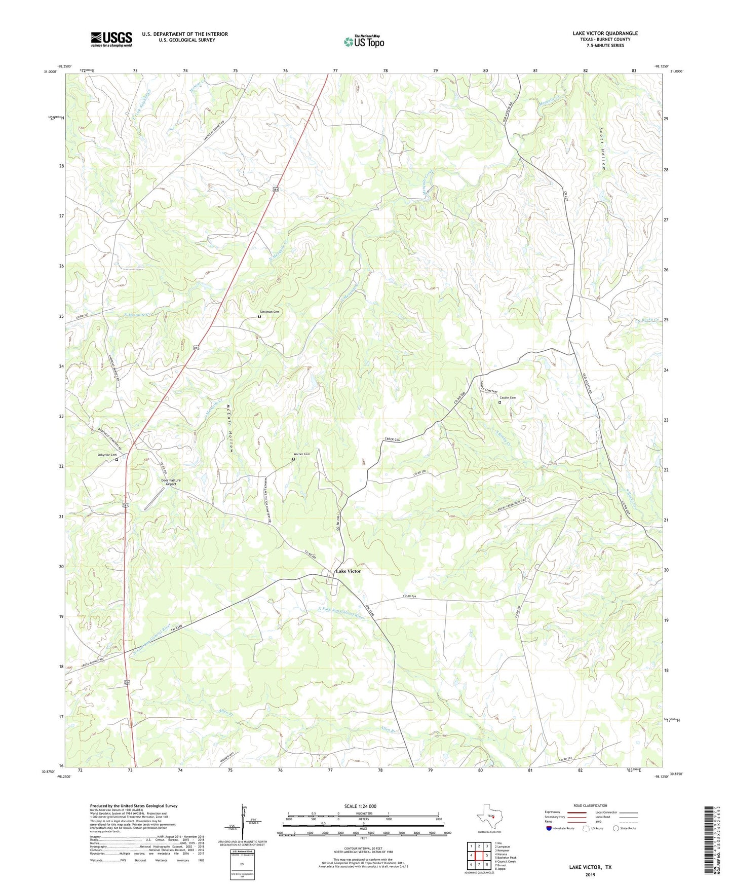
2022 topographic map quadrangle Lake Victor in the state of Texas. Scale: 1:24000. Based on the newly updated USGS 7.5' US Topo map series, this map is in the following counties: Burnet. The map contains contour data, water features, and other items you are used to seeing on USGS maps, but also has updated roads and other features. This is the next generation of topographic maps. Printed on high-quality waterproof paper with UV fade-resistant inks.
Quads adjacent to this one:
West: Naruna
Northwest: Nix
North: Lampasas
Northeast: Kempner
East: Bachelor Peak
Southeast: Joppa
South: Burnet
Southwest: Council Creek
This map covers the same area as the classic USGS quad with code o30098h2.
Contains the following named places: Allen Branch, Cauble Cemetery, Deer Pasture Airport, Dobyville Cemetery, Lake Victor, McCain Hollow, North Mesquite Creek, South Mesquite Creek, Sunnylane, Tumlinson Cemetery, Warner Cemetery