MyTopo
Oklahoma Flat Texas US Topo Map
Couldn't load pickup availability
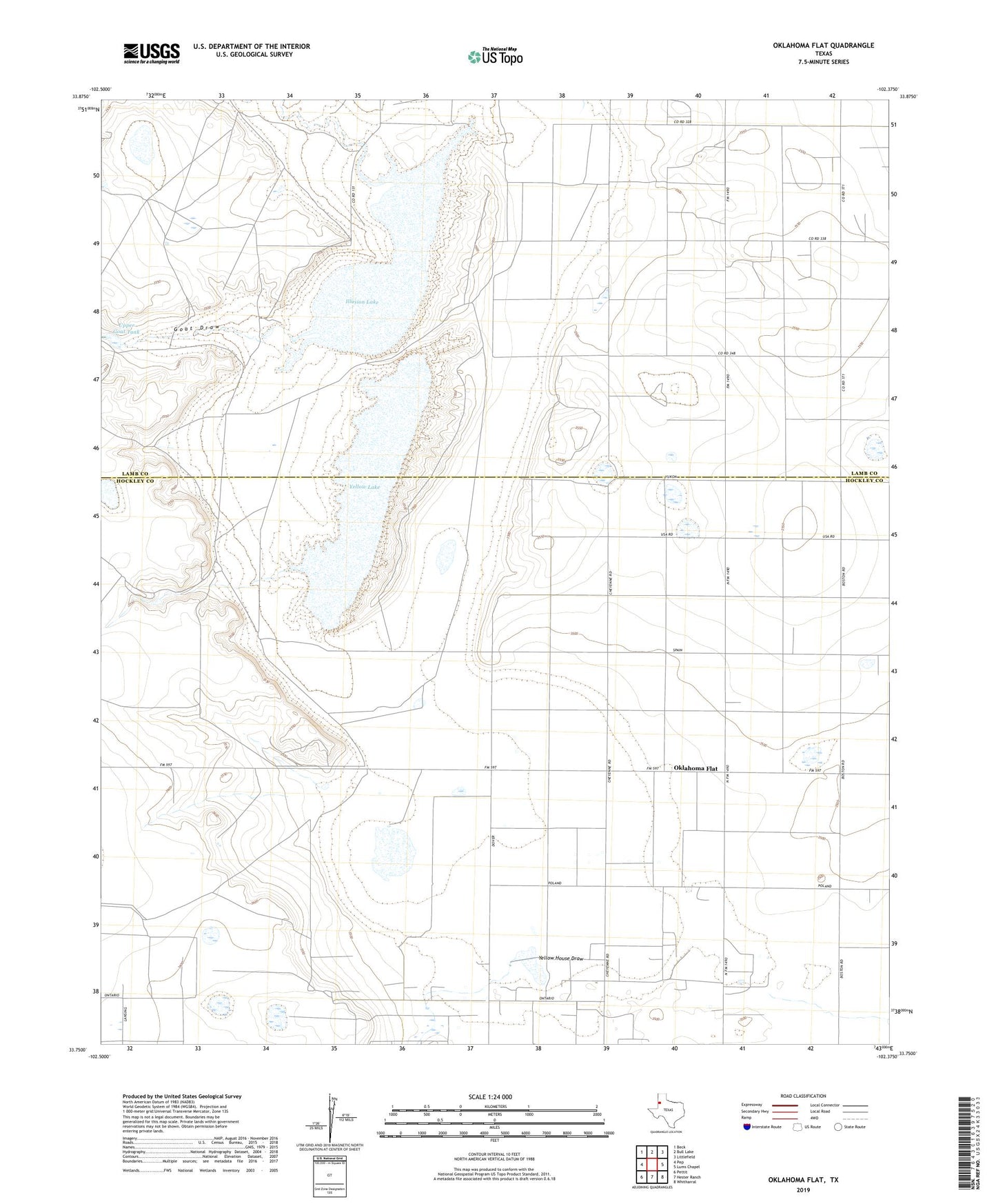
2019 topographic map quadrangle Oklahoma Flat in the state of Texas. Scale: 1:24000. Based on the newly updated USGS 7.5' US Topo map series, this map is in the following counties: Hockley, Lamb. The map contains contour data, water features, and other items you are used to seeing on USGS maps, but also has updated roads and other features. This is the next generation of topographic maps. Printed on high-quality waterproof paper with UV fade-resistant inks.
Quads adjacent to this one:
West: Pep
Northwest: Beck
North: Bull Lake
Northeast: Littlefield
East: Lums Chapel
Southeast: Whitharral
South: Hester Ranch
Southwest: Pettit
Contains the following named places: Bull Draw, Dry Tank, East Windmill, Goat Draw, Grapevine Tank, House Tank, Illusion Lake, Lower Goat Tank, Oklahoma Flat, Rattlesnake Tank, Rye Straw Windmill, South Pasture Tank, South Pasture Windmill, Upper Goat Tank, Yellow House Ranch, Yellow Lake