
MyTopo
Oklahoma Texas US Topo Map
Couldn't load pickup availability
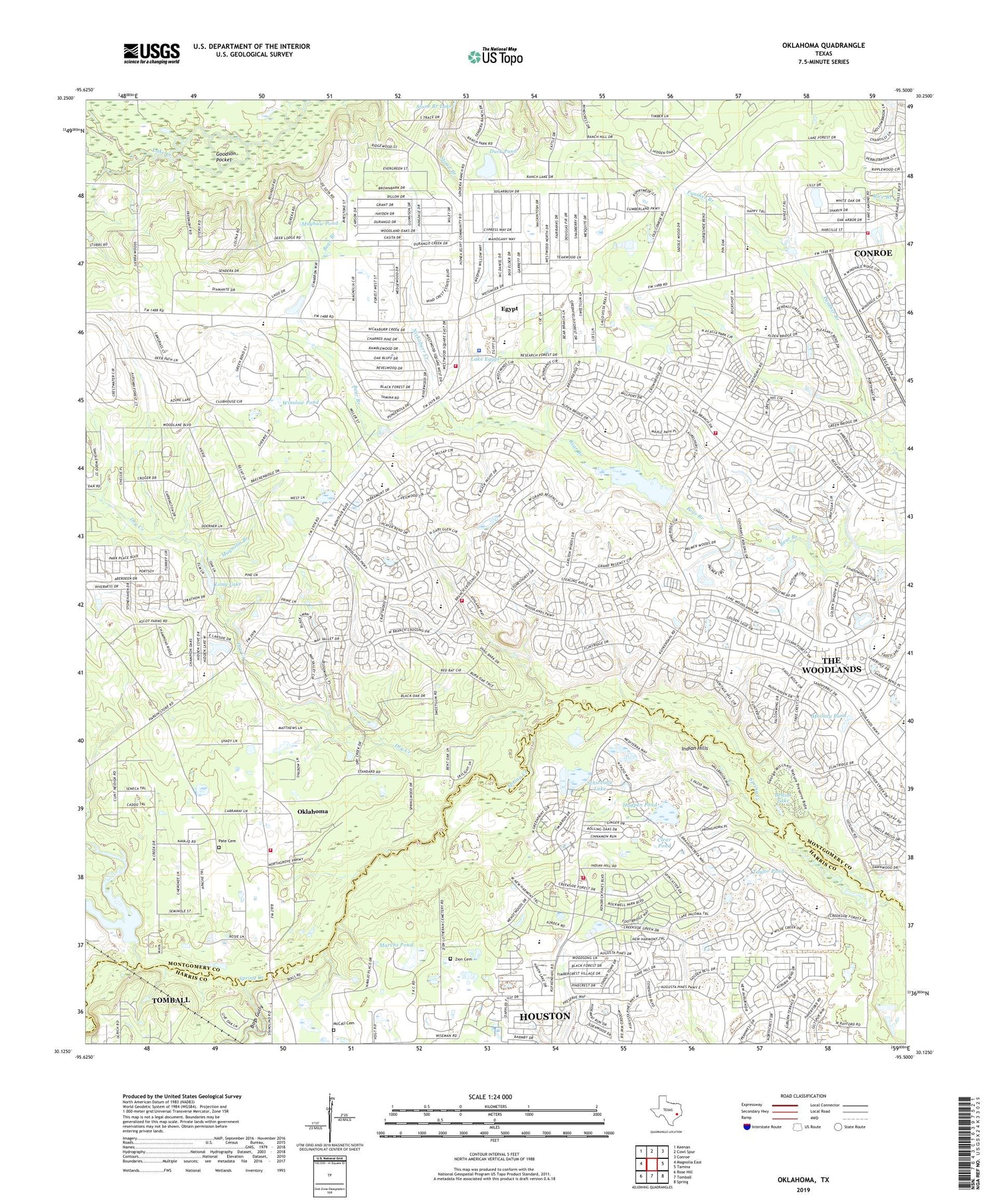
2019 topographic map quadrangle Oklahoma in the state of Texas. Scale: 1:24000. Based on the newly updated USGS 7.5' US Topo map series, this map is in the following counties: Montgomery, Harris. The map contains contour data, water features, and other items you are used to seeing on USGS maps, but also has updated roads and other features. This is the next generation of topographic maps. Printed on high-quality waterproof paper with UV fade-resistant inks.
Quads adjacent to this one:
West: Magnolia East
Northwest: Keenan
North: Cowl Spur
Northeast: Conroe
East: Tamina
Southeast: Spring
South: Tomball
Southwest: Rose Hill
Contains the following named places: Bear Branch Elementary School, Bear Branch Junior High School, Bedias Lake, Bogs Gully, Bush Elementary School, Church of Christ in Montgomery County, Church of the Nazarene, Clear Pond, Community Baptist Church, Community Christian Church, Congregation Beth Shalom of the Woodlands, David Elementary School, Decker Branch, Dry Creek, Duck Pond, Egypt, Galatas Elementary School, George Bell Madeley Cemetery, Goodson Pocket, Grace Presbyterian Church, Hogpen Pond, Hufsmith East Oil Field, Indian Hills, Indian Hills Oil Field, KSEV-AM (Tomball), Lake Egypt, Lake Egypt Dam, Long Lake, Lord of Life Lutheran Church, Magnolia Branch, Magnolia Volunteer Fire Department Station 182, Magnolia Volunteer Fire Department Station 186, Marchs Pond, Mayhaw Pond, McCall Cemetery, Mill Creek, Mitchell Intermediate School, Montgomery County Hospital District Emergency Medical Services Station 24, Montgomery County Hospital District Emergency Medical Services Station 87, Montgomery County Sheriff's Office - Patrol District 2 Substation, Mooney Pond, Needham Volunteer Fire Department Station 64, Neidigk Lake, Neidigk Lake Dam, Nickaburr Creek, Oklahoma, Panther Creek Post Office, Pate Cemetery, Powell Elementary School, Sally Ride Elementary School, Schweinle Lake, Spirit of Joy Lutheran Church, Stone Bridge Church, Tamina Arcenaut Oil Field, Taylor Pond, The Woodlands Census Designated Place, The Woodlands Church of the Nazarene, The Woodlands Fire Department Station 4, The Woodlands Fire Department Station 5, The Woodlands High School, Winslow Pond, Woodlands Community Presbyterian Church, Woodlands Nazarene Church, Woodlands United Methodist Church, Woods Edge Community Church, Zion Cemetery, ZIP Codes: 77381, 77382


