MyTopo
Rose Hill Texas US Topo Map
Couldn't load pickup availability
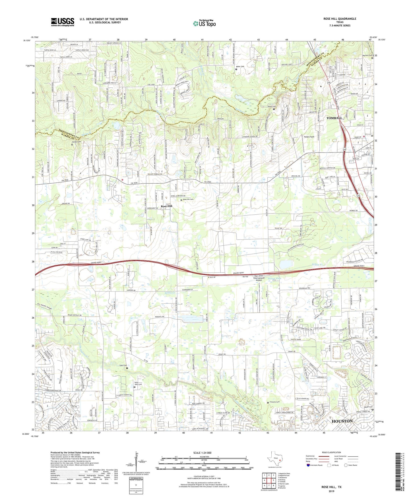
2022 topographic map quadrangle Rose Hill in the state of Texas. Scale: 1:24000. Based on the newly updated USGS 7.5' US Topo map series, this map is in the following counties: Harris, Montgomery. The map contains contour data, water features, and other items you are used to seeing on USGS maps, but also has updated roads and other features. This is the next generation of topographic maps. Printed on high-quality waterproof paper with UV fade-resistant inks.
Quads adjacent to this one:
West: Hockley
Northwest: Magnolia West
North: Magnolia East
Northeast: Oklahoma
East: Tomball
Southeast: Satsuma
South: Cypress
Southwest: Warren Lake
This map covers the same area as the classic USGS quad with code o30095a6.
Contains the following named places: Baker Cemetery, Beckendorf Intermediate School, Brown Park, Brushy Creek, City of Tomball Fire Department, Cougar Field - Tomball High School, Cougar Football Stadium - Tomball High School, Cypress Mill Baptist Church, Dan Jones International Airport, Decker Prairie Oil Field, Dyess County Park, Field's Field, Fritsche Cemetery, KYND-AM (Cypress), Letter M Ranch, Martens Cemetery, Meyer Cemetery, Northwest Harris Division, Northwest Rural Emergency Medical Service, Rose Hill, Rose Hill Cemetery, Rosehill Methodist Church, Rosehill Volunteer Fire Department Station 1, Saint John Cemetery, Saint John Church, Saint Sava Serbian Orthodox Church, Salem Cemetery, Sander Cemetery, Spring Creek Park, Tomball Assembly of God Church, Tomball Fire Department Station 1, Tomball High School, Tomball Junior High School, Tomball Oil Field, Tomball Post Office, Tomball Town Center, Treichel, Trinity Church, Walnut Creek, Willow Flats, Zahn Cemetery, ZIP Code: 77377