MyTopo
Palacios NE Texas US Topo Map
Couldn't load pickup availability
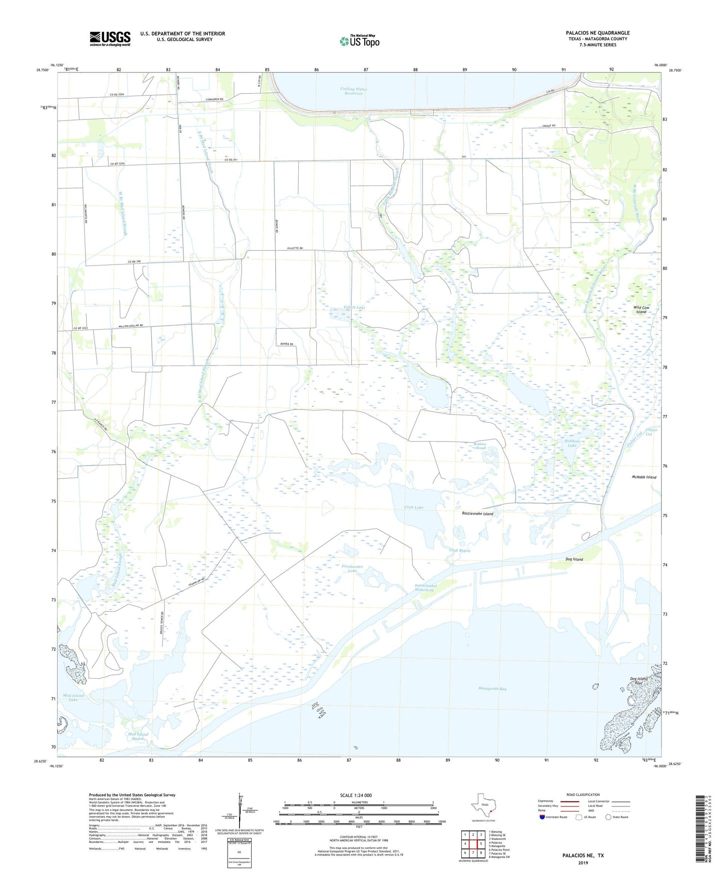
2019 topographic map quadrangle Palacios NE in the state of Texas. Scale: 1:24000. Based on the newly updated USGS 7.5' US Topo map series, this map is in the following counties: Matagorda. The map contains contour data, water features, and other items you are used to seeing on USGS maps, but also has updated roads and other features. This is the next generation of topographic maps. Printed on high-quality waterproof paper with UV fade-resistant inks.
Quads adjacent to this one:
West: Palacios
Northwest: Blessing
North: Blessing SE
Northeast: Wadsworth
East: Matagorda
Southeast: Matagorda SW
South: Palacios SE
Southwest: Palacios Point
Contains the following named places: Citrus Grove, Citrus Grove School, Cooling Water Reservoir Dam, Crab Bayou, Crab Lake, Culver Cut, Dog Island, East Branch Mad Island Slough, Freshwater Lake, Gillett Lake, Little Robbins Slough, Mad Island Bayou, Mad Island Lake, Mad Island Slough, Mad Island Wildlife Management Area, McNabb Island, Rattlesnake Island, Robbins Lake, Robbins Slough, Shell Island Reef, Shell Lakes, West Branch Mad Island Slough