MyTopo
Wadsworth Texas US Topo Map
Couldn't load pickup availability
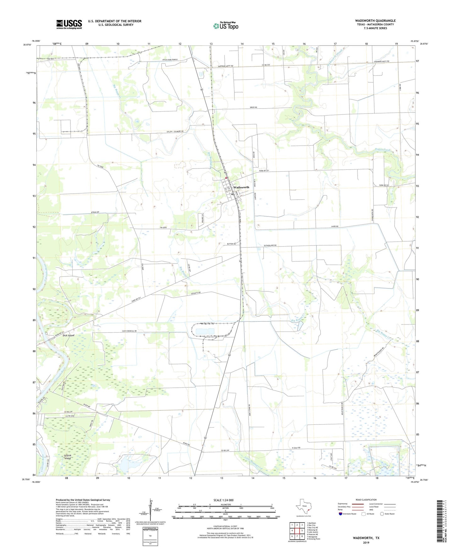
2022 topographic map quadrangle Wadsworth in the state of Texas. Scale: 1:24000. Based on the newly updated USGS 7.5' US Topo map series, this map is in the following counties: Matagorda. The map contains contour data, water features, and other items you are used to seeing on USGS maps, but also has updated roads and other features. This is the next generation of topographic maps. Printed on high-quality waterproof paper with UV fade-resistant inks.
Quads adjacent to this one:
West: Blessing SE
Northwest: Markham
North: Bay City
Northeast: Bay City NE
East: Lake Austin
Southeast: Dressing Point
South: Matagorda
Southwest: Palacios NE
This map covers the same area as the classic USGS quad with code o28095g8.
Contains the following named places: Dick Island, Donaldson Lake, East Reservoir, Gulf Hill, Matagorda Volunteer Fire Department, Rymers, Saint Francis Church, Selkirk Island, Wadsworth, Wadsworth Census Designated Place, Wadsworth Fire Department, Wadsworth Post Office, Wadsworth Slough, Willow Lake