
MyTopo
Pecan Springs Texas US Topo Map
Couldn't load pickup availability
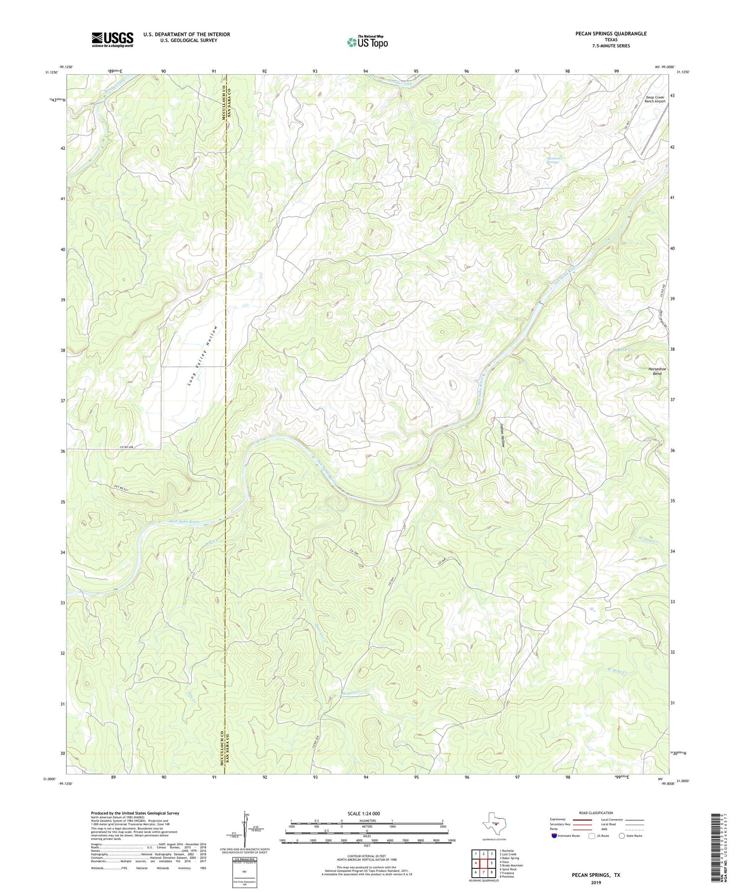
2019 topographic map quadrangle Pecan Springs in the state of Texas. Scale: 1:24000. Based on the newly updated USGS 7.5' US Topo map series, this map is in the following counties: San Saba, McCulloch. The map contains contour data, water features, and other items you are used to seeing on USGS maps, but also has updated roads and other features. This is the next generation of topographic maps. Printed on high-quality waterproof paper with UV fade-resistant inks.
Quads adjacent to this one:
West: Voca
Northwest: Rochelle
North: Lost Creek
Northeast: Baker Spring
East: Brady Mountain
Southeast: Pontotoc
South: Fredonia
Southwest: Spice Rock
Contains the following named places: Campbell Ranch, Deep Creek Ranch Airport, Deer Creek, Dry Creek, Hinton Creek, Horseshoe Bend, Indian Hollow, Indian Mound Windmill, Long Valley Hollow, New Windmill, Pecan Springs, Sorrell Ranch, Sorrell Windmill, Sycamore Springs


