MyTopo
Baker Spring Texas US Topo Map
Couldn't load pickup availability
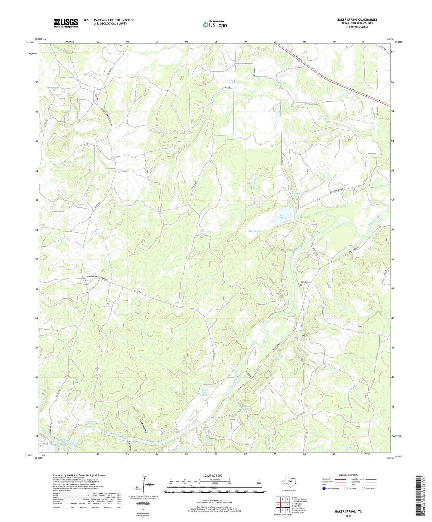
2022 topographic map quadrangle Baker Spring in the state of Texas. Scale: 1:24000. Based on the newly updated USGS 7.5' US Topo map series, this map is in the following counties: San Saba. The map contains contour data, water features, and other items you are used to seeing on USGS maps, but also has updated roads and other features. This is the next generation of topographic maps. Printed on high-quality waterproof paper with UV fade-resistant inks.
Quads adjacent to this one:
West: Lost Creek
Northwest: Hall
North: Richland Springs
Northeast: Blucher Mountain
East: Algerita
Southeast: Buffalo Knob
South: Brady Mountain
Southwest: Pecan Springs
This map covers the same area as the classic USGS quad with code o31098b8.
Contains the following named places: Baker Spring, Bluff Creek, Brady Creek, Cedar Hollow, Deep Creek Ranch Lake, Deep Creek Ranch Lake Dam, Deep Creek Spring, Flemming Spring, Hart Springs, King Creek, Lake Margery, Lake Margery Dam, New Hope Church, Rock Shoals Cumberland Church, Rocky Shoals Cemetery, Sloan, Sloan Pool Spring, Sloan School, Sloan Sisters Ranch, T F Hollow, Turkey Roost Creek, Turkey Roost Springs