
MyTopo
Petronila NE Texas US Topo Map
Couldn't load pickup availability
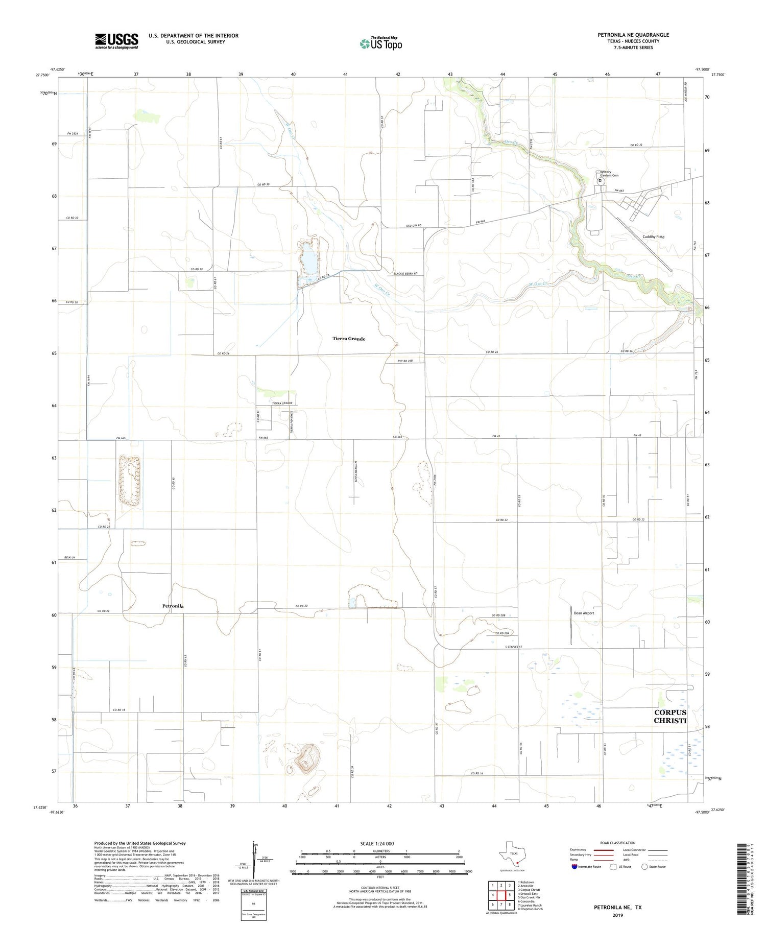
2019 topographic map quadrangle Petronila NE in the state of Texas. Scale: 1:24000. Based on the newly updated USGS 7.5' US Topo map series, this map is in the following counties: Nueces. The map contains contour data, water features, and other items you are used to seeing on USGS maps, but also has updated roads and other features. This is the next generation of topographic maps. Printed on high-quality waterproof paper with UV fade-resistant inks.
Quads adjacent to this one:
West: Driscoll East
Northwest: Robstown
North: Annaville
Northeast: Corpus Christi
East: Oso Creek NW
Southeast: Chapman Ranch
South: Laureles Ranch
Southwest: Concordia
Contains the following named places: Baldwin Oil Field, Belvy Lake, Belvy Lake Dam, Cuddihy Field, Dean Airport, KEDT-FM (Corpus Christi), KEDT-TV (Corpus Christi), KFGG-FM (Corpus Christi), KIII-TV (Corpus Christi), KLTG-FM (Corpus Christi), KLUX-FM (Robstown), KRIS-TV (Corpus Christi), KROB-FM (Robstown), KWVS-FM (Kingsville), KZFM-FM (Corpus Christi), Memory Gardens Cemetery, North Luby Oil Field, Nueces County, Ramada Oil Field, Shield Oil Field, Tierra Grande, Tierra Grande Census Designated Place, West Oso Creek


