MyTopo
Laureles Ranch Texas US Topo Map
Couldn't load pickup availability
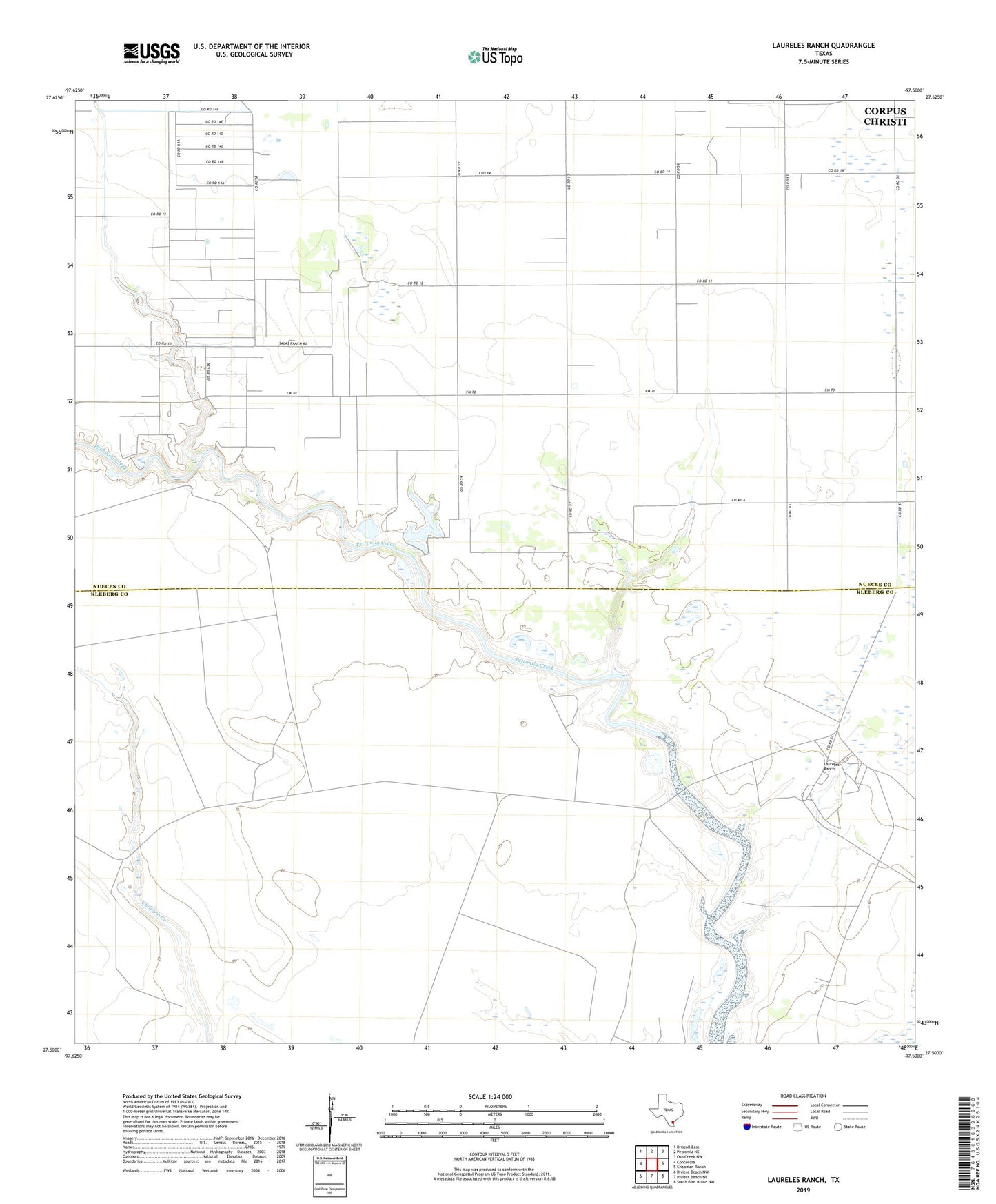
2022 topographic map quadrangle Laureles Ranch in the state of Texas. Scale: 1:24000. Based on the newly updated USGS 7.5' US Topo map series, this map is in the following counties: Nueces, Kleberg. The map contains contour data, water features, and other items you are used to seeing on USGS maps, but also has updated roads and other features. This is the next generation of topographic maps. Printed on high-quality waterproof paper with UV fade-resistant inks.
Quads adjacent to this one:
West: Concordia
Northwest: Driscoll East
North: Petronila NE
Northeast: Oso Creek NW
East: Chapman Ranch
Southeast: South Bird Island NW
South: Riviera Beach NE
Southwest: Riviera Beach NW
This map covers the same area as the classic USGS quad with code o27097e5.
Contains the following named places: Chapman Ranch Lake, Chapman Ranch Lake Dam, Chiltipin Windmill, Coyote Windmill, Don Roberto Windmill, Falcon Windmill, Field Twentyfive Windmill, Laureles Cemetery, Laureles Ranch, Luby Oil Field, Majiris Windmill, Noria Dan Windmill, Santa Cruz Ranch, Stanolind-Luby Camp Refinery, Verderas Windmill