MyTopo
Driscoll East Texas US Topo Map
Couldn't load pickup availability
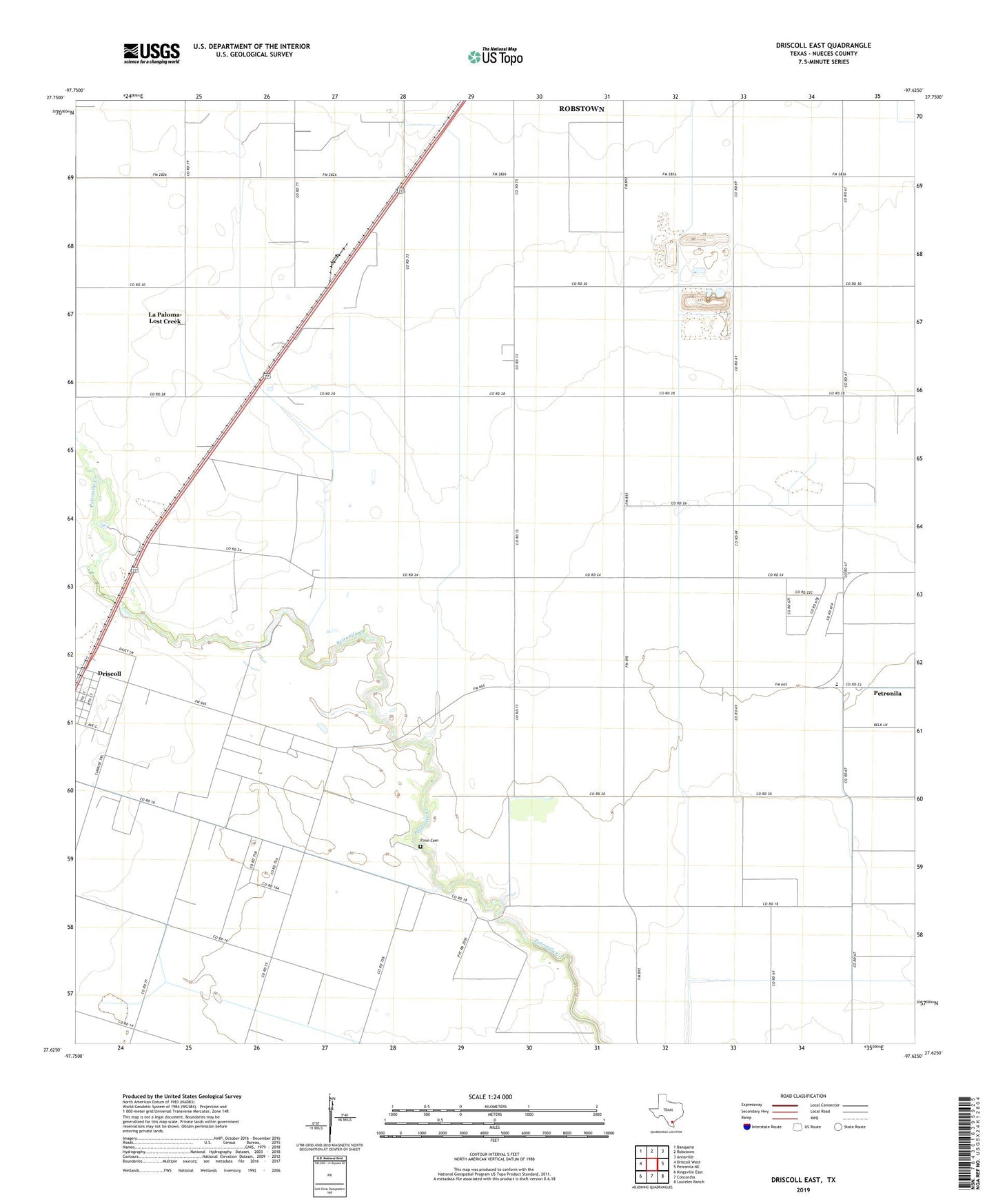
2022 topographic map quadrangle Driscoll East in the state of Texas. Scale: 1:24000. Based on the newly updated USGS 7.5' US Topo map series, this map is in the following counties: Nueces. The map contains contour data, water features, and other items you are used to seeing on USGS maps, but also has updated roads and other features. This is the next generation of topographic maps. Printed on high-quality waterproof paper with UV fade-resistant inks.
Quads adjacent to this one:
West: Driscoll West
Northwest: Banquete
North: Robstown
Northeast: Annaville
East: Petronila NE
Southeast: Laureles Ranch
South: Concordia
Southwest: Kingsville East
This map covers the same area as the classic USGS quad with code o27097f6.
Contains the following named places: City of Petronila, Clara Driscoll Oil Field, Coastal Bend Youth City, Coastal Bend Youth City School, Driscoll, Driscoll Division, Flinn Cemetery, Florida Gas Camp, Gandy Farms, KMIQ-FM (Robstown), La Paloma-Lost Creek Census Designated Place, Minnie Bock Oil Field, North Clara Driscoll Oil Field, Petronila, Petronila Elementary School