
MyTopo
Plantersville Texas US Topo Map
Couldn't load pickup availability
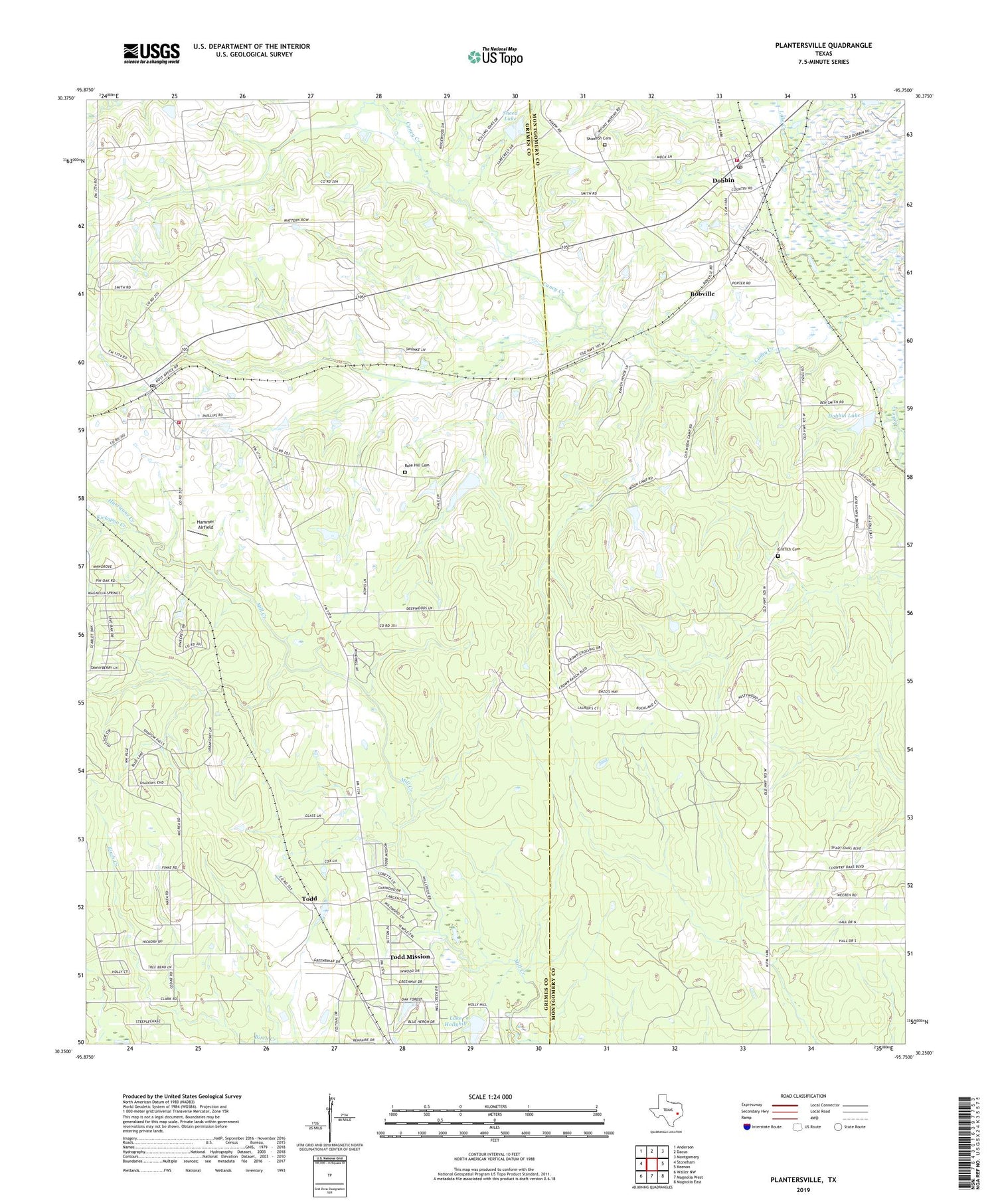
2019 topographic map quadrangle Plantersville in the state of Texas. Scale: 1:24000. Based on the newly updated USGS 7.5' US Topo map series, this map is in the following counties: Grimes, Montgomery. The map contains contour data, water features, and other items you are used to seeing on USGS maps, but also has updated roads and other features. This is the next generation of topographic maps. Printed on high-quality waterproof paper with UV fade-resistant inks.
Quads adjacent to this one:
West: Stoneham
Northwest: Anderson
North: Dacus
Northeast: Montgomery
East: Keenan
Southeast: Magnolia East
South: Magnolia West
Southwest: Waller NW
Contains the following named places: Bobville, Caney Creek, Center Point Church, City of Plantersville, City of Todd Mission, Dobbin, Dobbin Lake, Dobbin Lake Dam, Dobbin Post Office, Griffith Cemetery, Hammer Airfield, Hurricane Creek, Kickapoo Creek, Lake Hollyhill, Lake Hollyhill Dam, Micrea Lake, Micrea Lake Dam, Montgomery Fire Department Station 53, Plantersville, Plantersville - Stoneham Volunteer Fire Department, Plantersville Post Office, Rose Hill Cemetery, Rose Hill Church, Saint Mary Church, Shannon Cemetery, Sneed Lake, Sneed Lake Dam, Todd, Todd Mission, ZIP Code: 77363


