MyTopo
Dacus Texas US Topo Map
Couldn't load pickup availability
Also explore the Dacus Forest Service Topo of this same quad for updated USFS data
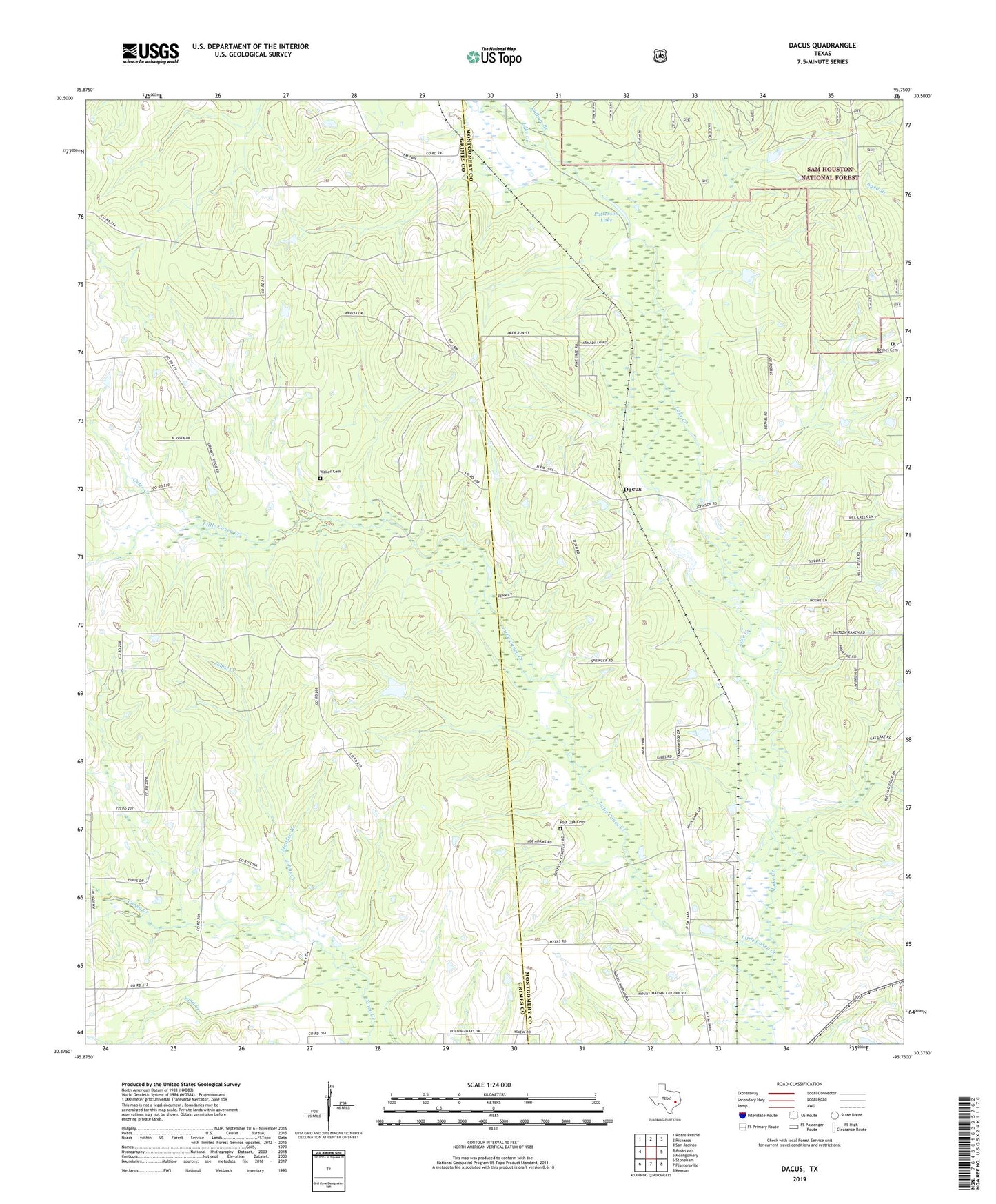
2022 topographic map quadrangle Dacus in the state of Texas. Scale: 1:24000. Based on the newly updated USGS 7.5' US Topo map series, this map is in the following counties: Grimes, Montgomery. The map contains contour data, water features, and other items you are used to seeing on USGS maps, but also has updated roads and other features. This is the next generation of topographic maps. Printed on high-quality waterproof paper with UV fade-resistant inks.
Quads adjacent to this one:
West: Anderson
Northwest: Roans Prairie
North: Richards
Northeast: San Jacinto
East: Montgomery
Southeast: Keenan
South: Plantersville
Southwest: Stoneham
This map covers the same area as the classic USGS quad with code o30095d7.
Contains the following named places: Bethel Cemetery, Blackberry, Dacus, Geter Creek, Johns Creek, Kidhaw Branch, Little Caney Creek, Madden Branch, Mount Mariah Church, Patterson Lake, Post Oak Cemetery, Sand Creek, Waller Cemetery