MyTopo
Porter Springs Texas US Topo Map
Couldn't load pickup availability
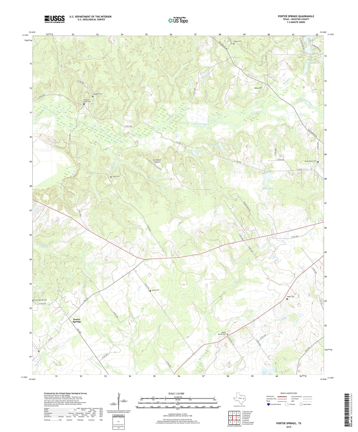
2019 topographic map quadrangle Porter Springs in the state of Texas. Scale: 1:24000. Based on the newly updated USGS 7.5' US Topo map series, this map is in the following counties: Houston. The map contains contour data, water features, and other items you are used to seeing on USGS maps, but also has updated roads and other features. This is the next generation of topographic maps. Printed on high-quality waterproof paper with UV fade-resistant inks.
Quads adjacent to this one:
West: Halls Bluff
Northwest: Stanmire Lake
North: Hays Spring
Northeast: Grapeland
East: Crockett
Southeast: Lovelady North
South: Pearsons Chapel
Southwest: Austonio
Contains the following named places: Aldrich Post Office, Bailey Church, Butler Lake, Campbell Cemetery, Dan Jenkins Creek, Dixon Hopewell Church, Edmiston Dam, Gary Hill, Hagan Cemetery, Langum Quarter, M Y Ranch Airport, Mayes Cemetery, Mount Moriah Cemetery, Mustang Prairie, Old Groves School, Pleasant Grove Cemetery, Porter Branch, Porter Springs, Porter Springs Community Volunteer Fire Department, Rocky Mount Cemetery, Saint Mathew Church, Salt Branch Creek, Salt Branch School, Skalicky Dam, Skalicky Lake, Smith Cemetery, Spring Creek, Spring Creek Country Club, Spring Creek Country Club Lake, Spring Creek Country Club Lake Dam, Union Chapel, Wesley Cemetery, Wesley Chapel, Wesley Chapel School, Wesley Methodist Chapel Church, Williams High School, Wirt Lake, Wirt Lake Dam