MyTopo
Lovelady North Texas US Topo Map
Couldn't load pickup availability
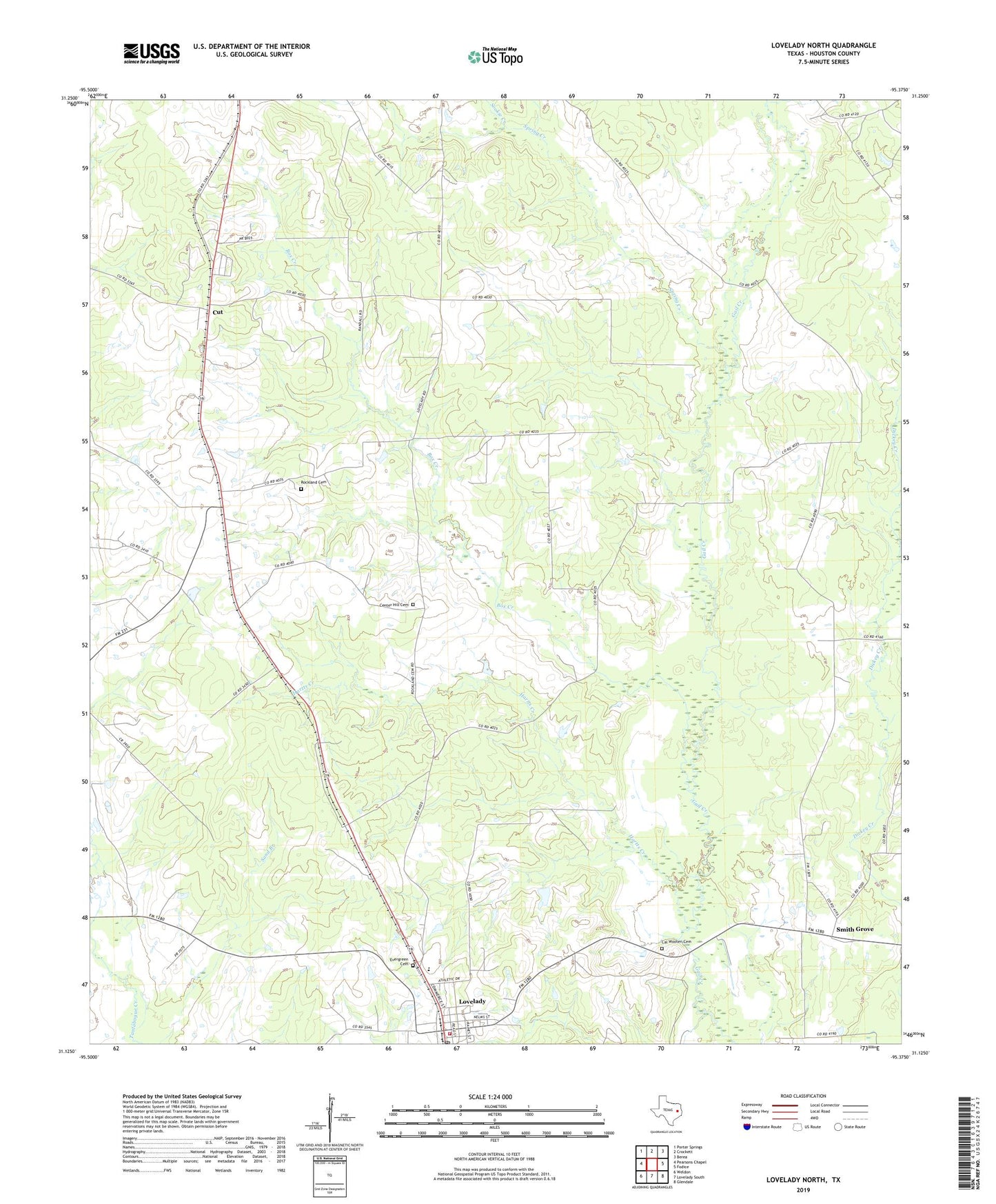
2022 topographic map quadrangle Lovelady North in the state of Texas. Scale: 1:24000. Based on the newly updated USGS 7.5' US Topo map series, this map is in the following counties: Houston. The map contains contour data, water features, and other items you are used to seeing on USGS maps, but also has updated roads and other features. This is the next generation of topographic maps. Printed on high-quality waterproof paper with UV fade-resistant inks.
Quads adjacent to this one:
West: Pearsons Chapel
Northwest: Porter Springs
North: Crockett
Northeast: Berea
East: Fodice
Southeast: Glendale
South: Lovelady South
Southwest: Weldon
This map covers the same area as the classic USGS quad with code o31095b4.
Contains the following named places: Anderson Chapel United Methodist Church, Box Creek, Cal Wooten Cemetery, Center Grove, Center Grove Nutrition Center, Center Grove School, Center Hill Cemetery, City of Lovelady, Clay Fulcher Dam, Clay Fulcher Lake, Cut, Evergreen Cemetery, Hartts Creek, Lone Pine, Lone Pine Church, Lovelady, Lovelady City Hall, Lovelady Elementary School, Lovelady High School, Lovelady High School Football Stadium, Lovelady Post Office, Lovelady Volunteer Fire Department, Mount Olive Baptist Church, Pleasant Hill Methodist Church, Rockland Cemetery, Smith Grove, Smith Grove Church of Christ, Sookie Creek, South Hillside Church, Spring Creek