
MyTopo
Potrero Cortado Texas US Topo Map
Couldn't load pickup availability
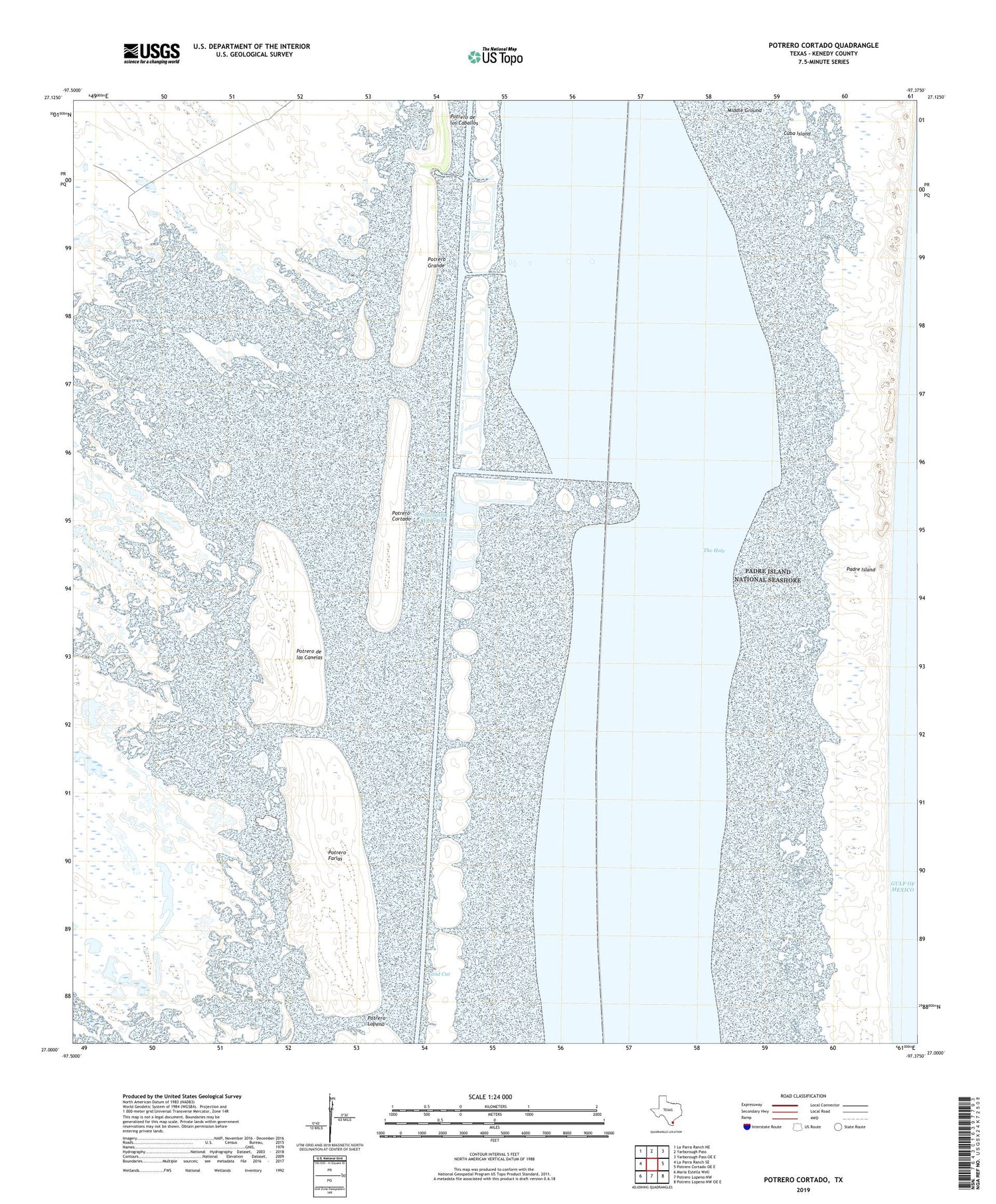
2019 topographic map quadrangle Potrero Cortado in the state of Texas. Scale: 1:24000. Based on the newly updated USGS 7.5' US Topo map series, this map is in the following counties: Kenedy. The map contains contour data, water features, and other items you are used to seeing on USGS maps, but also has updated roads and other features. This is the next generation of topographic maps. Printed on high-quality waterproof paper with UV fade-resistant inks.
Quads adjacent to this one:
West: La Parra Ranch SE
Northwest: La Parra Ranch NE
North: Yarborough Pass
Northeast: Yarborough Pass OE E
East: Potrero Cortado OE E
Southeast: Potrero Lopeno NW OE E
South: Potrero Lopeno NW
Southwest: Maria Estella Well
Contains the following named places: Cuba Island, Land Cut, Lopena Artesian Well, Medanito Well, Potrero Cortado, Potrero de las Canelas, Potrero Farias, Potrero Grande, The Hole


