MyTopo
Proffitt Crossing Texas US Topo Map
Couldn't load pickup availability
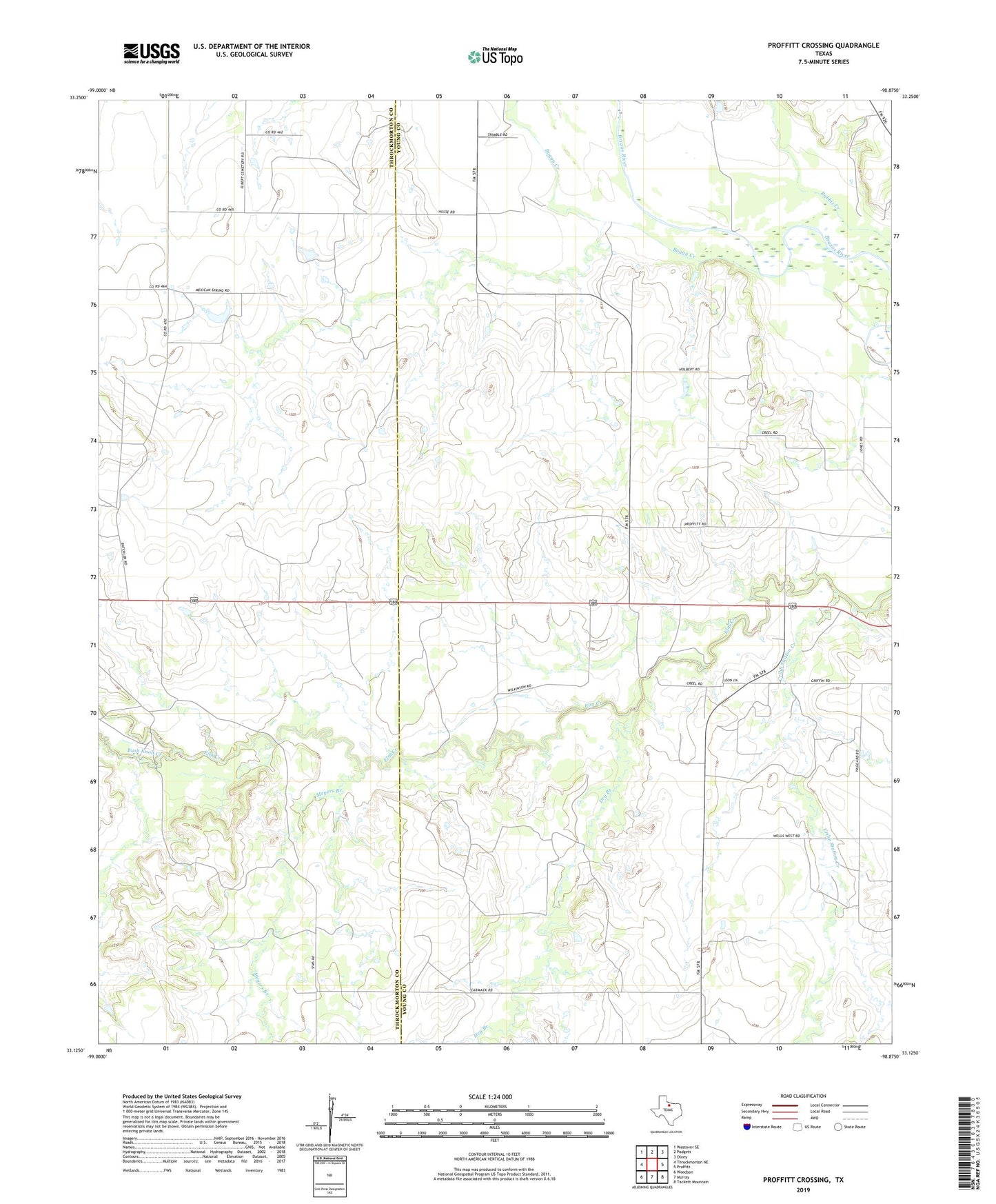
2019 topographic map quadrangle Proffitt Crossing in the state of Texas. Scale: 1:24000. Based on the newly updated USGS 7.5' US Topo map series, this map is in the following counties: Young, Throckmorton. The map contains contour data, water features, and other items you are used to seeing on USGS maps, but also has updated roads and other features. This is the next generation of topographic maps. Printed on high-quality waterproof paper with UV fade-resistant inks.
Quads adjacent to this one:
West: Throckmorton NE
Northwest: Westover SE
North: Padgett
Northeast: Olney
East: Proffitt
Southeast: Tackett Mountain
South: Murray
Southwest: Woodson
Contains the following named places: Boggy Creek, Bush Knob Creek, Cribb Station Creek, Dry Branch, Meyers Branch, Proffitt Crossing