MyTopo
Putnam South Texas US Topo Map
Couldn't load pickup availability
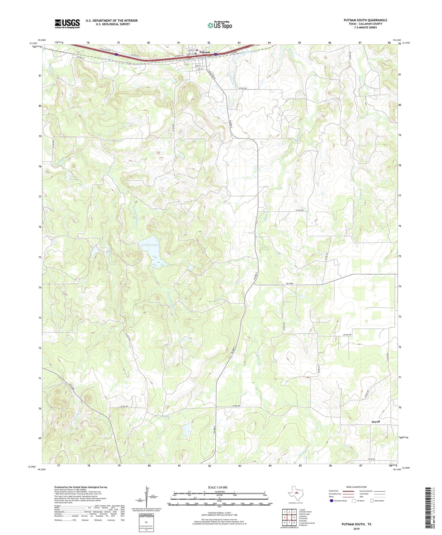
2019 topographic map quadrangle Putnam South in the state of Texas. Scale: 1:24000. Based on the newly updated USGS 7.5' US Topo map series, this map is in the following counties: Callahan. The map contains contour data, water features, and other items you are used to seeing on USGS maps, but also has updated roads and other features. This is the next generation of topographic maps. Printed on high-quality waterproof paper with UV fade-resistant inks.
Quads adjacent to this one:
West: Admiral
Northwest: Jayell
North: Putnam North
Northeast: Bernie Lake
East: Scranton
Southeast: Sabanno
South: Cross Plains North
Southwest: Rowden
Contains the following named places: Atwell, Atwell Cemetery, East Fork Brushy Creek, La Reata Dam, La Reata Lake, Putnam, Putnam Cemetery, Putnam Dam, Putnam Lake, Putnam Post Office, Putnam Volunteer Fire Department, Town of Putnam, Zion Hill Cemetery, ZIP Code: 76469