MyTopo
Bernie Lake Texas US Topo Map
Couldn't load pickup availability
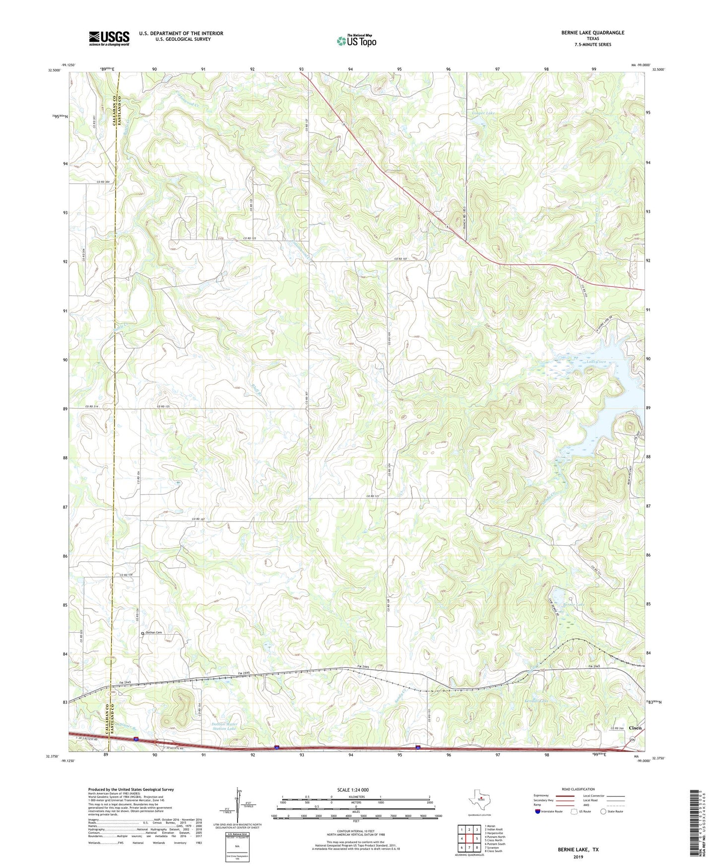
2022 topographic map quadrangle Bernie Lake in the state of Texas. Scale: 1:24000. Based on the newly updated USGS 7.5' US Topo map series, this map is in the following counties: Eastland, Callahan. The map contains contour data, water features, and other items you are used to seeing on USGS maps, but also has updated roads and other features. This is the next generation of topographic maps. Printed on high-quality waterproof paper with UV fade-resistant inks.
Quads adjacent to this one:
West: Putnam North
Northwest: Moran
North: Indian Knoll
Northeast: Harpersville
East: Cisco North
Southeast: Cisco South
South: Scranton
Southwest: Putnam South
This map covers the same area as the classic USGS quad with code o32099d1.
Contains the following named places: Battle Creek Channel Lake, Bernie Lake, Bluff Branch, Cisco Division, Cooper Lake, Cooper Lake Dam, Cottonwood Creek, Dothan, Dothan Cemetery, Dothan Water Station Lake, Dothan Water Station Levee, Kendall Lake, Kendall Lake Dam, Lake Cisco, Pueblo, Retention Dam, ZIP Code: 76437