MyTopo
Admiral Texas US Topo Map
Couldn't load pickup availability
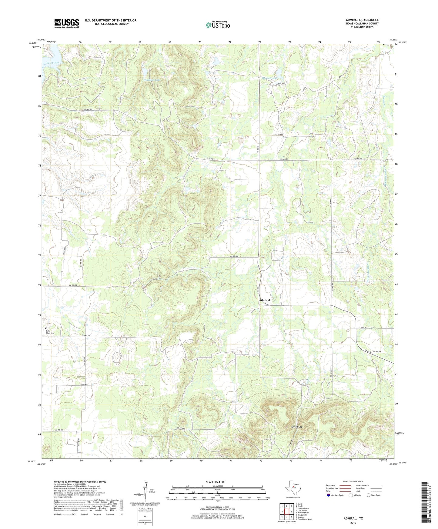
2022 topographic map quadrangle Admiral in the state of Texas. Scale: 1:24000. Based on the newly updated USGS 7.5' US Topo map series, this map is in the following counties: Callahan. The map contains contour data, water features, and other items you are used to seeing on USGS maps, but also has updated roads and other features. This is the next generation of topographic maps. Printed on high-quality waterproof paper with UV fade-resistant inks.
Quads adjacent to this one:
West: Club Hollow
Northwest: Baird
North: Jayell
Northeast: Putnam North
East: Putnam South
Southeast: Cross Plains North
South: Rowden
Southwest: Rowden NW
This map covers the same area as the classic USGS quad with code o32099c3.
Contains the following named places: Admiral, Admiral Cemetery, Baird Lake, Belle Plain, Belle Plain Cemetery, Callahan City Cemetery, Callahan County, Hatchett Lake, Hatchett Lake Dam, Spring Gap, West Fork Brushy Creek, Windham Lake, Windham Lake Dam, ZIP Code: 79504