MyTopo
Rankin Texas US Topo Map
Couldn't load pickup availability
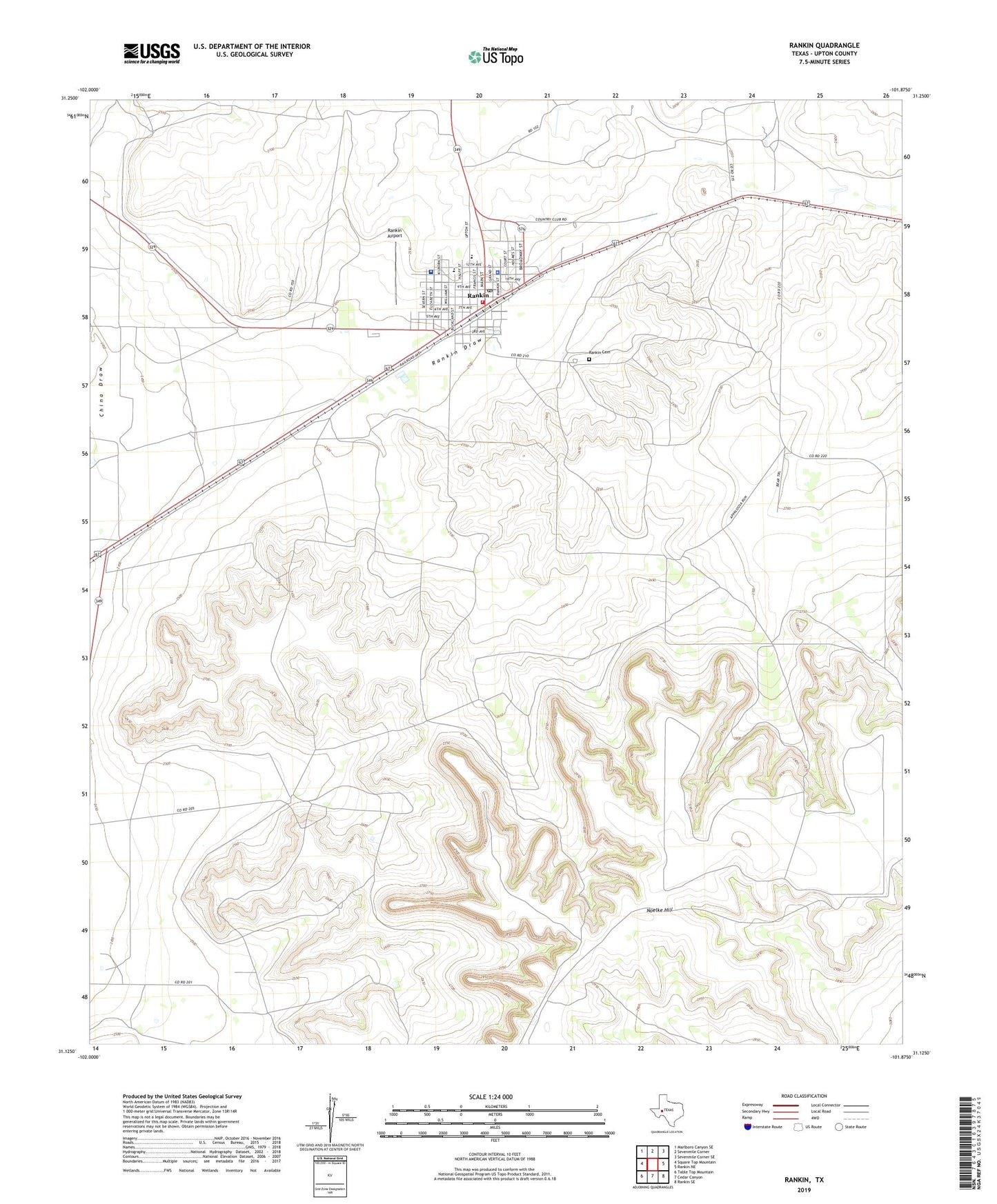
2019 topographic map quadrangle Rankin in the state of Texas. Scale: 1:24000. Based on the newly updated USGS 7.5' US Topo map series, this map is in the following counties: Upton. The map contains contour data, water features, and other items you are used to seeing on USGS maps, but also has updated roads and other features. This is the next generation of topographic maps. Printed on high-quality waterproof paper with UV fade-resistant inks.
Quads adjacent to this one:
West: Square Top Mountain
Northwest: Marlboro Canyon SE
North: Sevenmile Corner
Northeast: Sevenmile Corner SE
East: Rankin NE
Southeast: Rankin SE
South: Cedar Canyon
Southwest: Table Top Mountain
Contains the following named places: City of Rankin, Dub Day Arena, Noelke Hill, Rankin, Rankin Airport, Rankin Cemetery, Rankin City Hall, Rankin County Hospital, Rankin High School, Rankin Post Office, Rankin Volunteer Ambulance, Rankin Volunteer Fire Department, Taylor Windmill, Upton County Constable's Office Precinct 1, Upton County Law Enforcement Center, Upton County Sheriff's Office, ZIP Code: 79778