MyTopo
Sabinal Texas US Topo Map
Couldn't load pickup availability
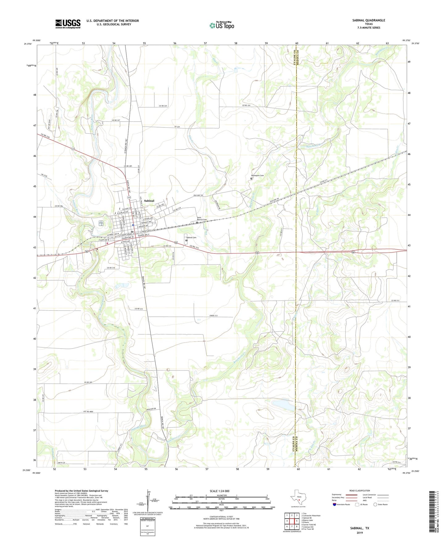
2019 topographic map quadrangle Sabinal in the state of Texas. Scale: 1:24000. Based on the newly updated USGS 7.5' US Topo map series, this map is in the following counties: Uvalde, Medina. The map contains contour data, water features, and other items you are used to seeing on USGS maps, but also has updated roads and other features. This is the next generation of topographic maps. Printed on high-quality waterproof paper with UV fade-resistant inks.
Quads adjacent to this one:
West: Blanco Lake
Northwest: Trio
North: Comanche Waterhole
Northeast: Sabinal NE
Southeast: Frio Town NE
South: Irishman Hill
Southwest: Garner Field NE
Contains the following named places: Bader Lake, Bader Lake Dam, City of Sabinal, Davenport Cemetery, Elm Creek, Nelson Lake, Nelson Lake Dam, Rancheros Creek, Sabinal, Sabinal Cemetery, Sabinal City Hall, Sabinal City Park, Sabinal Emergency Medical Service, Sabinal Police Department, Sabinal Post Office, Sabinal Volunteer Fire Department, Saint Patrick Cemetery