MyTopo
Garner Field NE Texas US Topo Map
Couldn't load pickup availability
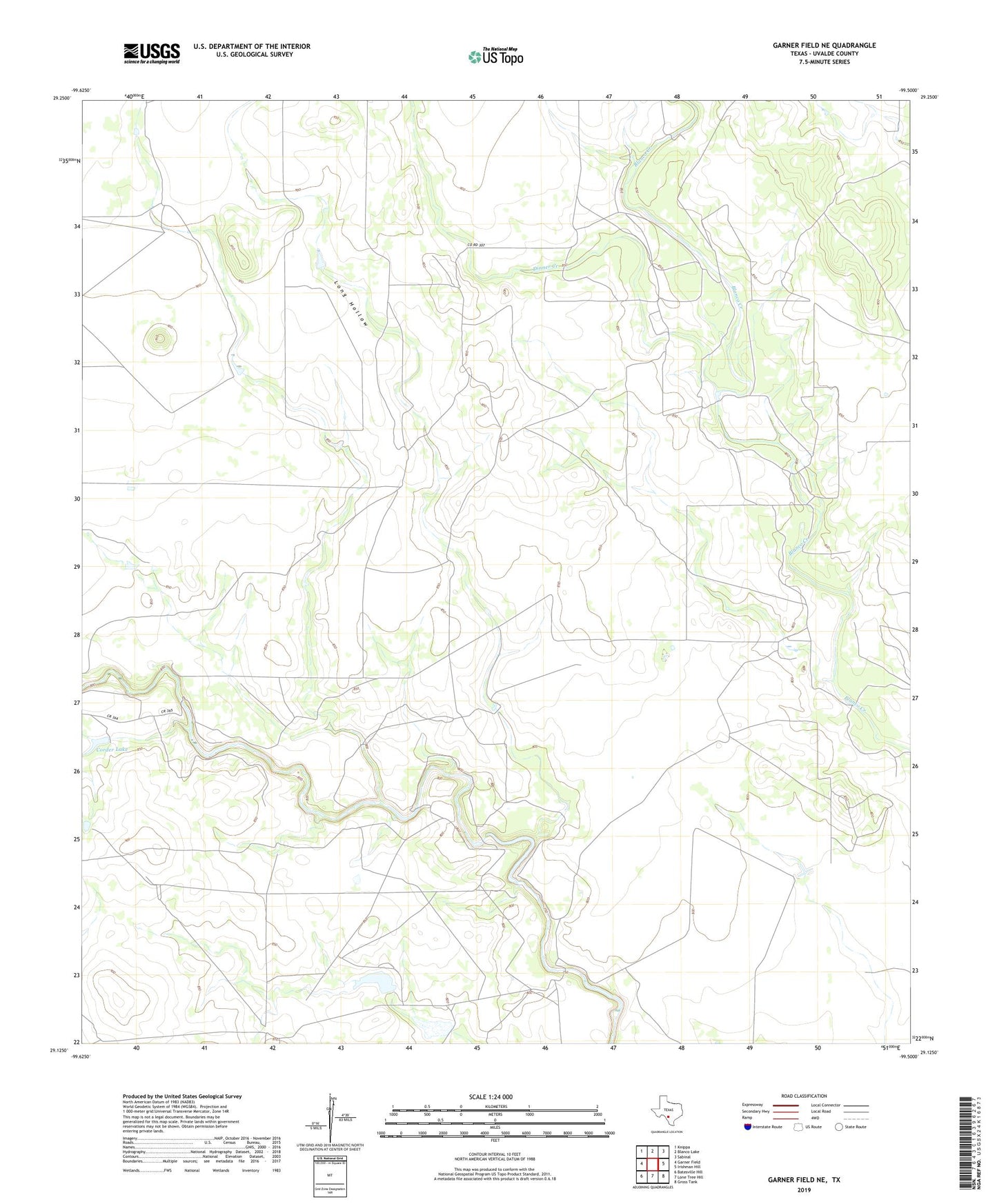
2022 topographic map quadrangle Garner Field NE in the state of Texas. Scale: 1:24000. Based on the newly updated USGS 7.5' US Topo map series, this map is in the following counties: Uvalde. The map contains contour data, water features, and other items you are used to seeing on USGS maps, but also has updated roads and other features. This is the next generation of topographic maps. Printed on high-quality waterproof paper with UV fade-resistant inks.
Quads adjacent to this one:
West: Garner Field
Northwest: Knippa
North: Blanco Lake
Northeast: Sabinal
East: Irishman Hill
Southeast: Gross Tank
South: Lone Tree Hill
Southwest: Batesville Hill
This map covers the same area as the classic USGS quad with code o29099b5.
Contains the following named places: Corder Lake, Corder Lake Dam, Dinner Creek, Frank Kincaid Lake Number 1 Dam, Kincaid Lake Number 1, Long Hollow, Reagan Lake, Reagan Lake Dam