MyTopo
San Geronimo Texas US Topo Map
Couldn't load pickup availability
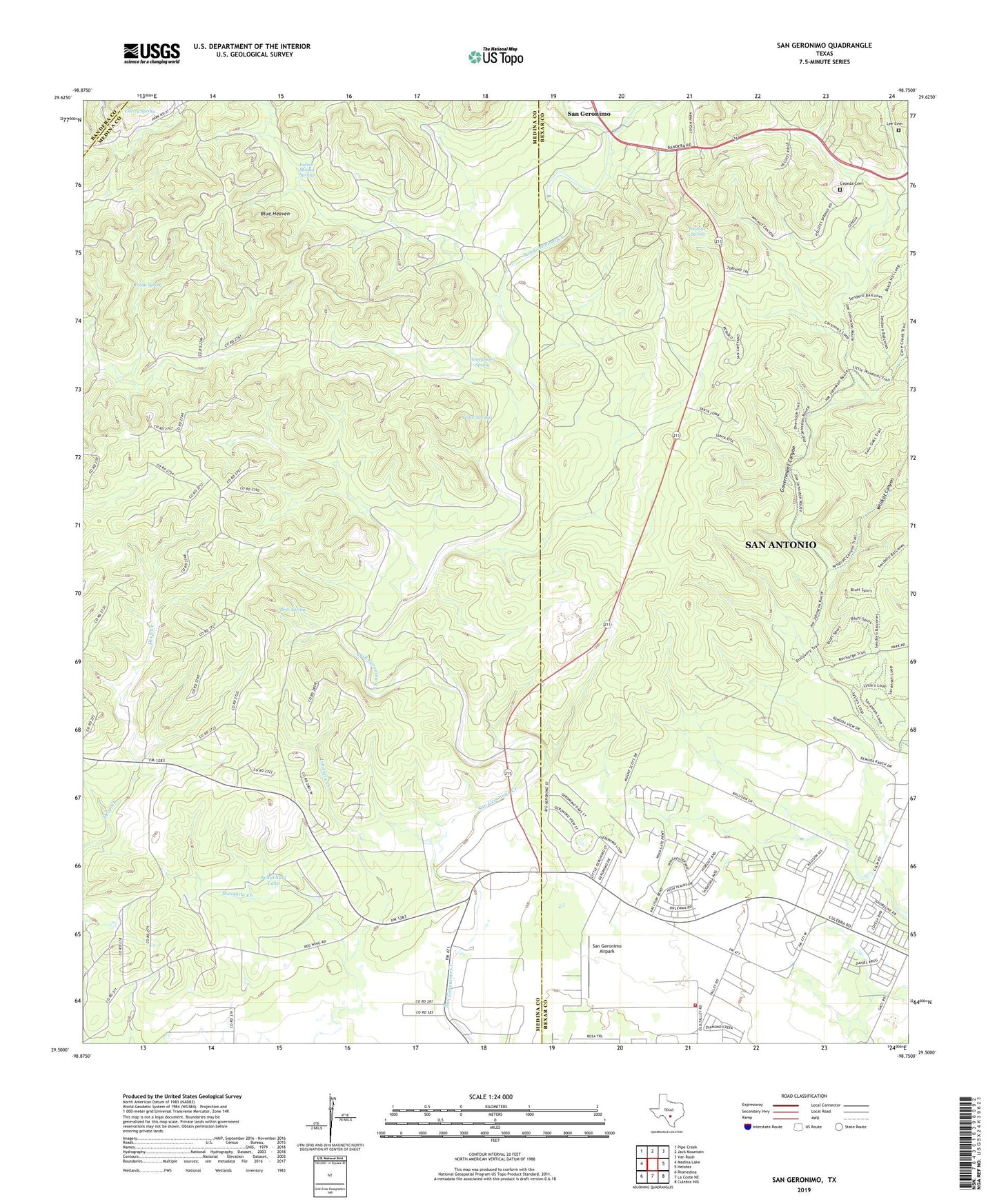
2019 topographic map quadrangle San Geronimo in the state of Texas. Scale: 1:24000. Based on the newly updated USGS 7.5' US Topo map series, this map is in the following counties: Medina, Bexar, Bandera. The map contains contour data, water features, and other items you are used to seeing on USGS maps, but also has updated roads and other features. This is the next generation of topographic maps. Printed on high-quality waterproof paper with UV fade-resistant inks.
Quads adjacent to this one:
West: Medina Lake
Northwest: Pipe Creek
North: Jack Mountain
Northeast: Van Raub
East: Helotes
Southeast: Culebra Hill
South: La Coste NE
Southwest: Riomedina
Contains the following named places: Alamo Seventh Day Church of God, Bear Spring, Blue Heaven, Cedar Springs, Cepeda Cemetery, Cherry Spring, Cliff, East Windmill, Gallagher Ranch, Geronimo Creek Quarry, Government Canyon, Government Canyon State Natural Area, High Lonesome Well, Honeymoon Spring, Indian Mound Springs, Kallison Ranch, KKYX-AM (San Antonio), Limekiln Creek, Little Windmill, Maverick School, Moses Windmill, Pastora Spring, Pecan Spring, River Windmill, San Geronimo, San Geronimo Airpark, San Geronimo Recharge Dam, San Geronimo Recharge Lake, Schuchart Lake, Schuchart Lake Dam, West Windmill, Wildcat Canyon, Wildcat Windmill, Zapeta Windmill, ZIP Code: 78066