MyTopo
Pipe Creek Texas US Topo Map
Couldn't load pickup availability
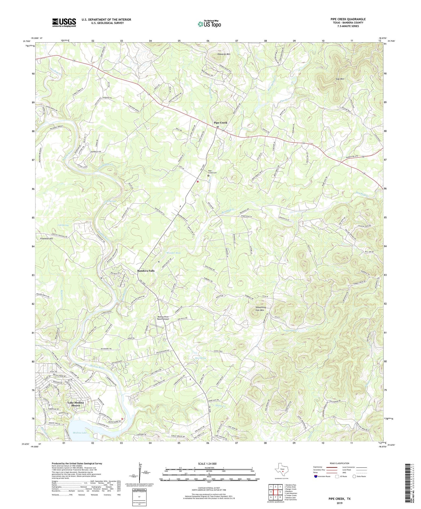
2022 topographic map quadrangle Pipe Creek in the state of Texas. Scale: 1:24000. Based on the newly updated USGS 7.5' US Topo map series, this map is in the following counties: Bandera. The map contains contour data, water features, and other items you are used to seeing on USGS maps, but also has updated roads and other features. This is the next generation of topographic maps. Printed on high-quality waterproof paper with UV fade-resistant inks.
Quads adjacent to this one:
West: Bandera
Northwest: Bandera Pass
North: Turkey Knob
Northeast: Ranger Creek
East: Jack Mountain
Southeast: San Geronimo
South: Medina Lake
Southwest: Timber Creek
This map covers the same area as the classic USGS quad with code o29098f8.
Contains the following named places: Bandera County Constable's Office Precinct 2, Bandera Falls, Barnes Branch, Bear Springs Creek, Bowl Spring, Bruins Creek, Cap Mountain, Coal Springs, Cold Springs, Dry Hollow Creek, Edwards Mountain, English Crossing, Fivemile Hill, Lake Medina Shores Census Designated Place, Lakehills, Lakeshore Volunteer Fire Department, Medina River Ranch Airport, Norton Spring, Pipe Creek, Pipe Creek Cemetery, Pipe Creek Post Office, Pipe Creek Volunteer Fire Department, Privilege Creek, Red Bluff Creek, Smoothing Iron Mountain, Spires Creek, Taylors Saddle Mountain Ranch Airport, Wonder Hole, ZIP Code: 78063