MyTopo
San Ygnacio Texas US Topo Map
Couldn't load pickup availability
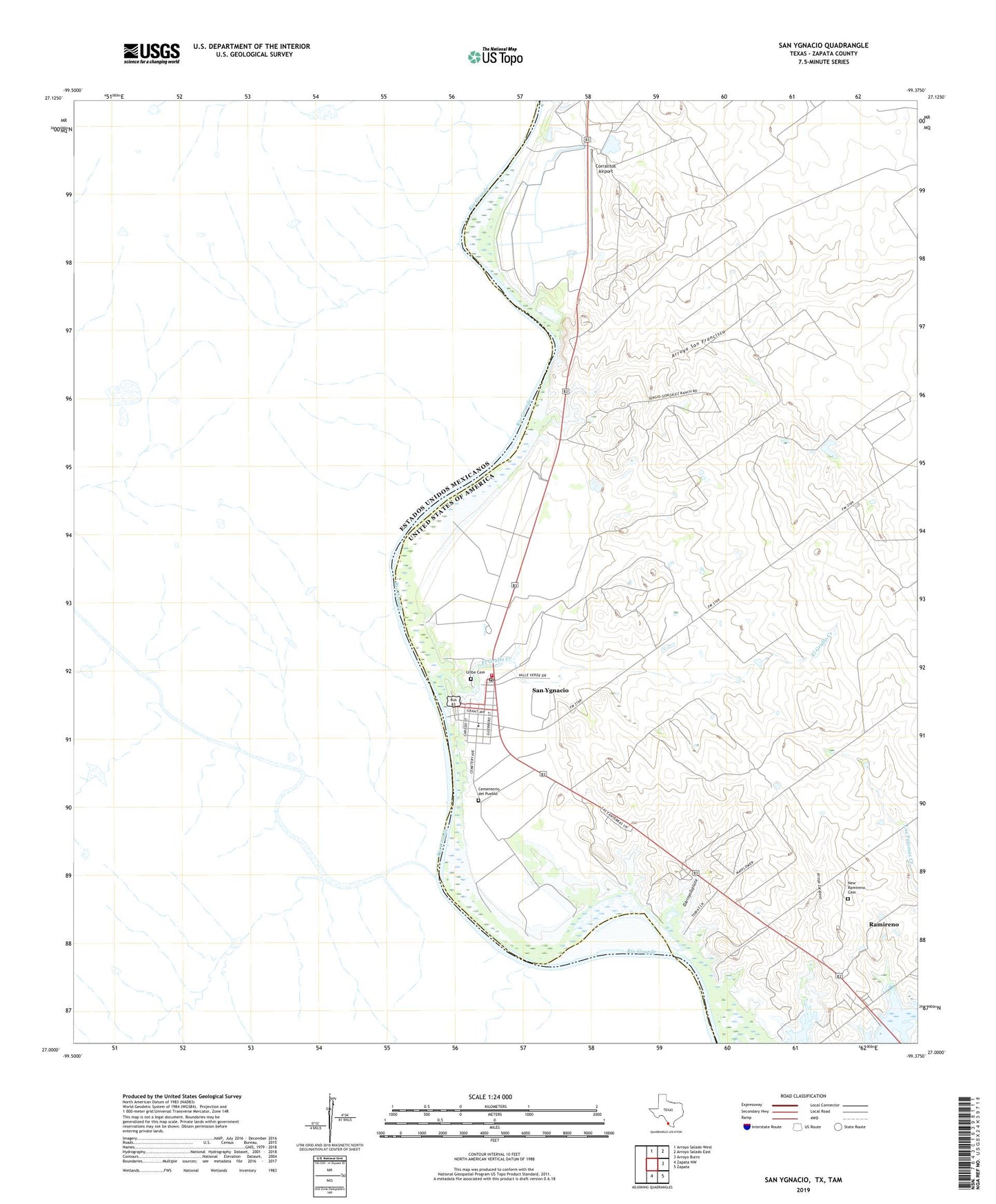
2019 topographic map quadrangle San Ygnacio in the state of Texas. Scale: 1:24000. Based on the newly updated USGS 7.5' US Topo map series, this map is in the following counties: Zapata. The map contains contour data, water features, and other items you are used to seeing on USGS maps, but also has updated roads and other features. This is the next generation of topographic maps. Printed on high-quality waterproof paper with UV fade-resistant inks.
Quads adjacent to this one:
North: Arroyo Salado West
Northeast: Arroyo Salado East
East: Arroyo Burro
Southeast: Zapata
South: Zapata NW
Contains the following named places: Arroyo San Francisco, Arroyo Zacatoso, Benavides Elementary School, Buoy 34, Buoy 35, Buoy 36, Cementerio del Pueblo, Corralitos Airport, El Arroyo Zopilote, El Grullo Creek, Mecom Lake, Mecom Lake Dam, New Ramireno Cemetery, Ramireno, Ramireno Census Designated Place, San Ignacio Viejo Unit 2 Colonia, San Ygnacio, San Ygnacio Census Designated Place, San Ygnacio Post Office, Uribe Cemetery, Valle Verde Colonia, Zapata County Fire Department Station 2