MyTopo
Arroyo Salado West Texas US Topo Map
Couldn't load pickup availability
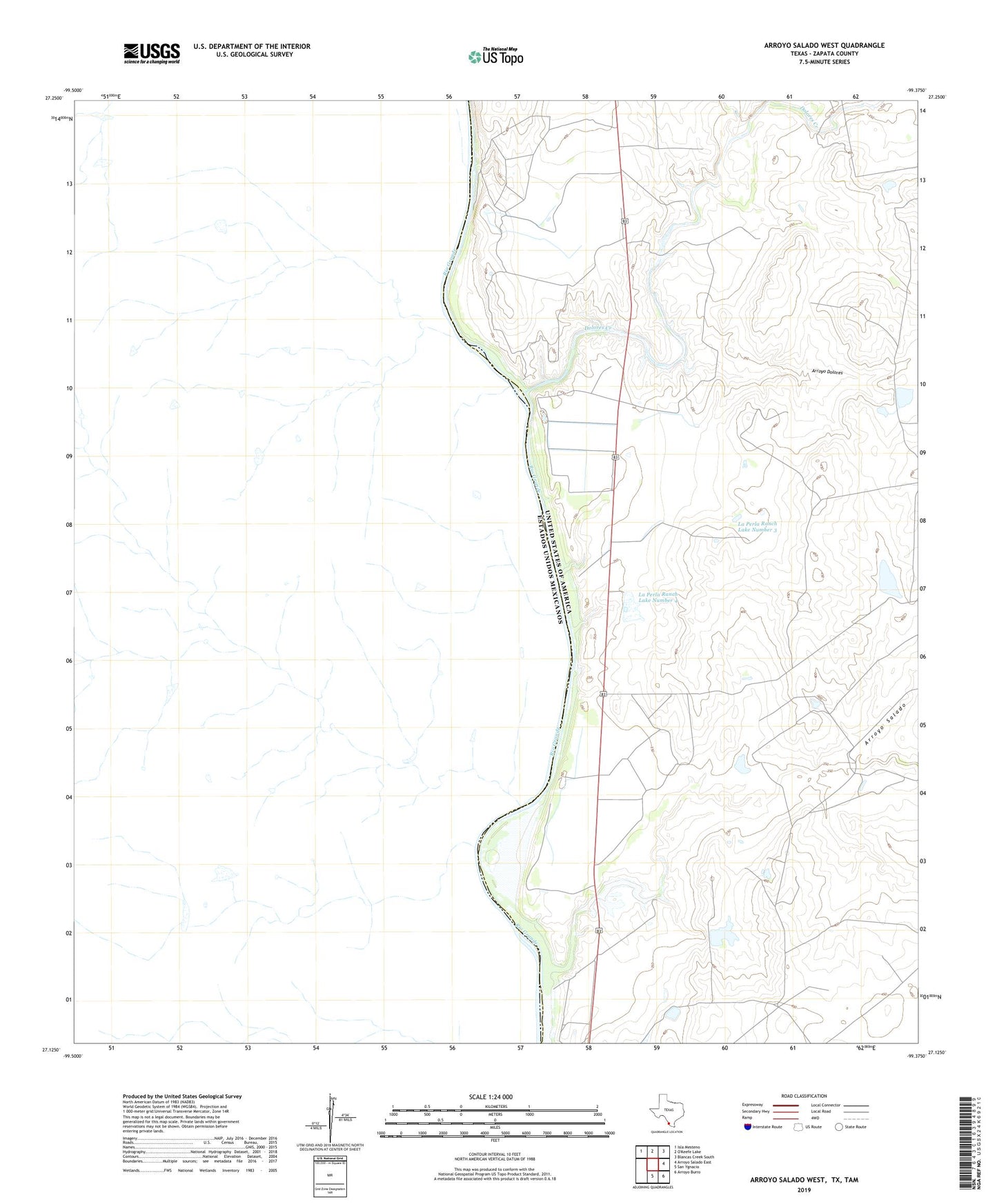
2022 topographic map quadrangle Arroyo Salado West in the state of Texas. Scale: 1:24000. Based on the newly updated USGS 7.5' US Topo map series, this map is in the following counties: Zapata. The map contains contour data, water features, and other items you are used to seeing on USGS maps, but also has updated roads and other features. This is the next generation of topographic maps. Printed on high-quality waterproof paper with UV fade-resistant inks.
Quads adjacent to this one:
Northwest: Isla Mesteno
Northeast: Blancas Creek South
East: Arroyo Salado East
Southeast: Arroyo Burro
South: San Ygnacio
This map covers the same area as the classic USGS quad with code o27099b4.
Contains the following named places: Arroyo Dolores, Arroyo Salado, Dolores Creek, Jesse McNeel Lake Number 1, Jesse McNeel Lake Number 1 Dam, La Perla Ranch Lake Number 2, La Perla Ranch Lake Number 2 Dam, La Perla Ranch Lake Number 3, La Perla Ranch Lake Number 3 Dam, La Perla Ranch Lake Number 4, La Perla Ranch Lake Number 4 Dam, La Perla Ranch Lake Number 5, La Perla Ranch Lake Number 5 Dam, Mission Dolores a Vista, Poblacion de Dolores