MyTopo
Schwab City Texas US Topo Map
Couldn't load pickup availability
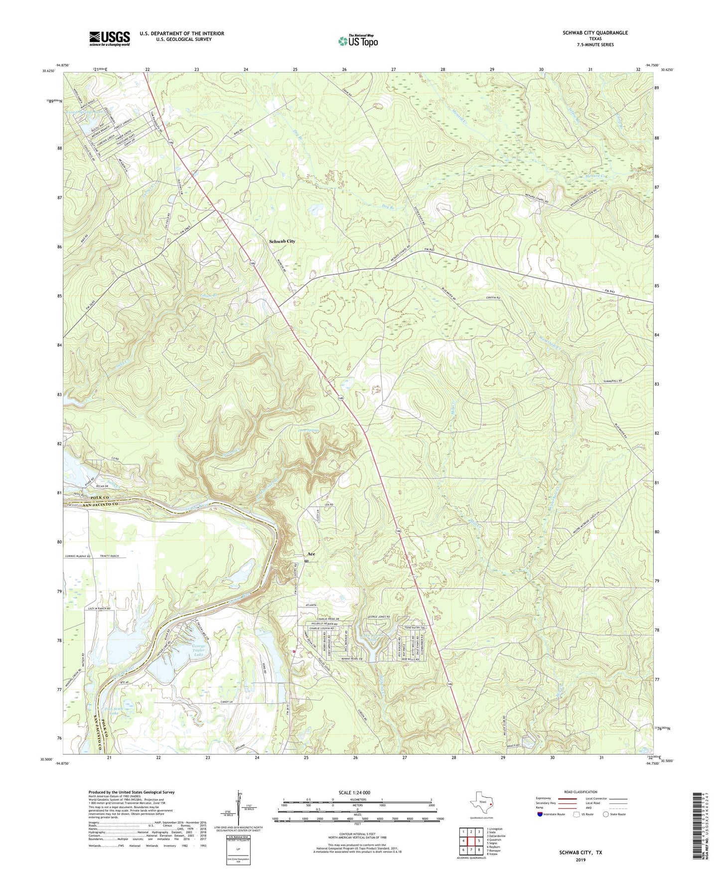
2019 topographic map quadrangle Schwab City in the state of Texas. Scale: 1:24000. Based on the newly updated USGS 7.5' US Topo map series, this map is in the following counties: Polk, San Jacinto. The map contains contour data, water features, and other items you are used to seeing on USGS maps, but also has updated roads and other features. This is the next generation of topographic maps. Printed on high-quality waterproof paper with UV fade-resistant inks.
Quads adjacent to this one:
West: Goodrich
Northwest: Livingston
North: Soda
Northeast: Dallardsville
East: Segno
Southeast: Votaw
South: Romayor
Southwest: Rayburn
Contains the following named places: Ace, Ace Emanuel Branch, Ace Post Office, Blue Branch, C J Gerlach Dam, Camp Branch, Devils Lake, Devils Lake Dam, Drew Springs, Drews Landing, Dry Branch, Fish Scale Lake, Forest Springs Lake, Forest Springs Lake Dam, George Taylor Lake, Gerlach Lake, Isham Branch, Lake Connie Jean, Lake Connie Jean Dam, Livingston Oil Field, Logan League, Munson Lake, Sally Creek, Schwab City, Schwab Oil Field, Second Creek, South Polk County Volunteer Fire Department, Taylor Lake, Taylor Lake Dam, Waterhole Creek, Yellow Branch, ZIP Code: 77326