
MyTopo
Shaeffer Ranch Texas US Topo Map
Couldn't load pickup availability
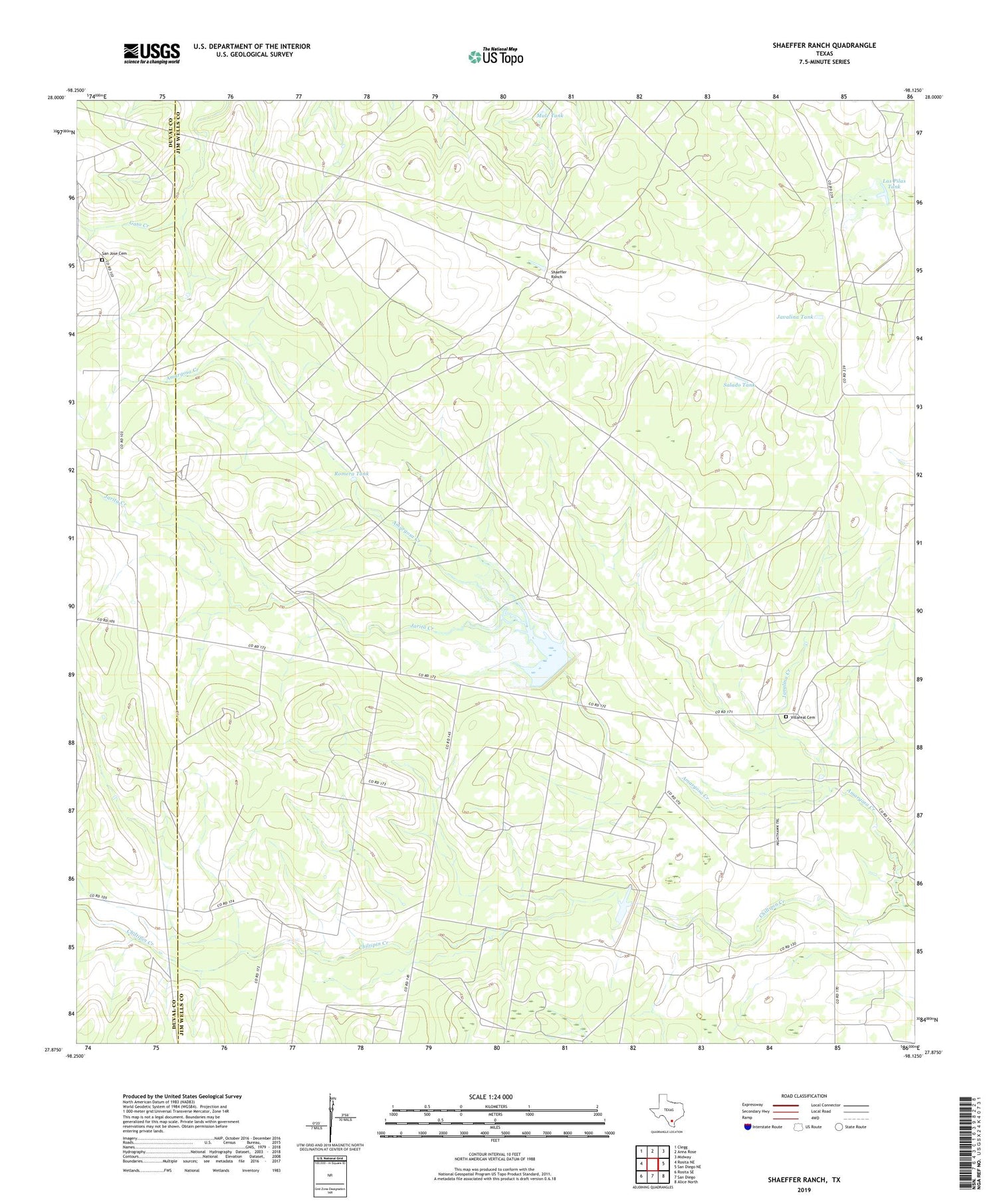
2019 topographic map quadrangle Shaeffer Ranch in the state of Texas. Scale: 1:24000. Based on the newly updated USGS 7.5' US Topo map series, this map is in the following counties: Jim Wells, Duval. The map contains contour data, water features, and other items you are used to seeing on USGS maps, but also has updated roads and other features. This is the next generation of topographic maps. Printed on high-quality waterproof paper with UV fade-resistant inks.
Quads adjacent to this one:
West: Rosita NE
Northwest: Clegg
North: Anna Rose
Northeast: Midway
East: San Diego NE
Southeast: Alice North
South: San Diego
Southwest: Rosita SE
Contains the following named places: Amargosa Creek, Amargosa Oil Field, Blanca Windmill, Chiltipin-San Fernando Dam Number 1, El Carro, Jarita Creek, Javalina Creek, Javalina Tank, Javalina Windmill, Las Pilas Tank, Las Pilas Windmill, Mendiates, Mendiates Windmill, Mule Tank, Oil Windmill, Romera Tank, Romera Windmill, Salado Tank, San Jose Cemetery, Semicek Windmill, Shaeffer Ranch, Soil Conservation Service 1 Dam, Soil Conservation Service 4 Dam, Soil Conservation Service Site 1 Reservoir, Soil Conservation Service Site 4 Reservoir, Villareal Cemetery, Yellowtop Windmill


