MyTopo
Midway Texas US Topo Map
Couldn't load pickup availability
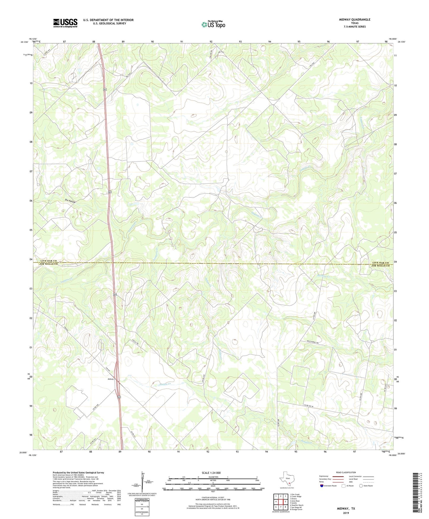
2022 topographic map quadrangle Midway in the state of Texas. Scale: 1:24000. Based on the newly updated USGS 7.5' US Topo map series, this map is in the following counties: Live Oak, Jim Wells. The map contains contour data, water features, and other items you are used to seeing on USGS maps, but also has updated roads and other features. This is the next generation of topographic maps. Printed on high-quality waterproof paper with UV fade-resistant inks.
Quads adjacent to this one:
West: Anna Rose
Northwest: Elm Creek
North: Crater Ridge
Northeast: Dinero
East: Sandia
Southeast: Orange Grove
South: San Diego NE
Southwest: Shaeffer Ranch
This map covers the same area as the classic USGS quad with code o28098a1.
Contains the following named places: Dix Hollow, Foster Windmill, Hinnant Oil Field, Julian Creek, Longoria Creek, Longoria Windmill, Los Ebanos Ranch Airport, Midway, Penitas Ranch, Stehle Oil Field, Vally-Hi Acres Number 2 Colonia, Williams Windmill