MyTopo
San Diego NE Texas US Topo Map
Couldn't load pickup availability
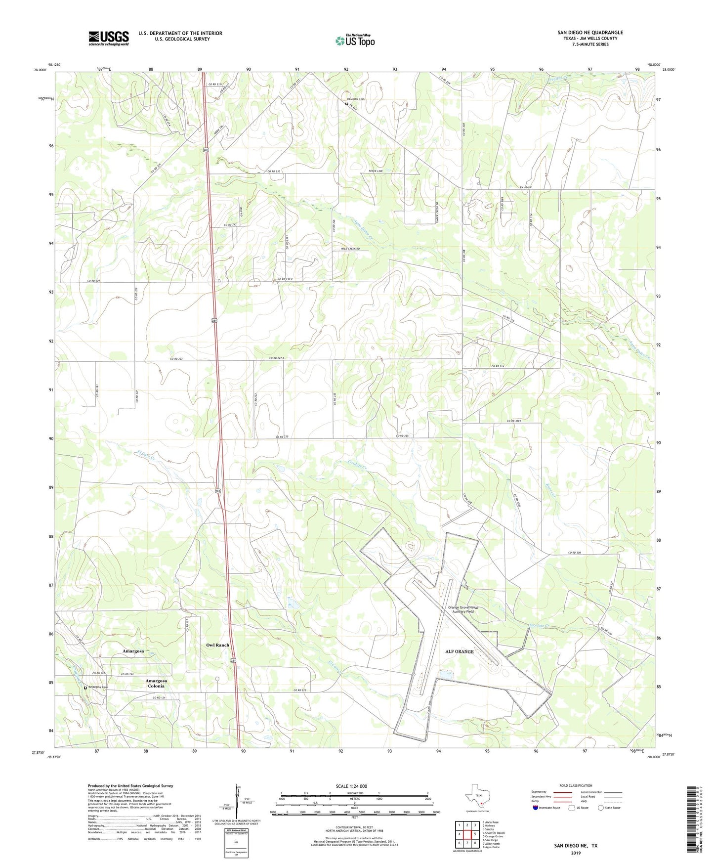
2022 topographic map quadrangle San Diego NE in the state of Texas. Scale: 1:24000. Based on the newly updated USGS 7.5' US Topo map series, this map is in the following counties: Jim Wells. The map contains contour data, water features, and other items you are used to seeing on USGS maps, but also has updated roads and other features. This is the next generation of topographic maps. Printed on high-quality waterproof paper with UV fade-resistant inks.
Quads adjacent to this one:
West: Shaeffer Ranch
Northwest: Anna Rose
North: Midway
Northeast: Sandia
East: Orange Grove
Southeast: Agua Dulce
South: Alice North
Southwest: San Diego
This map covers the same area as the classic USGS quad with code o27098h1.
Contains the following named places: Agua Dulce Ranch Number 1 Colonia, Agua Dulce Ranch Number 2 Colonia, Agua Dulce Ranch Number 3 Colonia, Aimee Acres Colonia, Aimee Acres Number 2 Colonia, Alfred Oil Field, Amargosa Cemetery, Amargosa Census Designated Place, Amargosa Colonia, Amargosa Number 2 Colonia, Dilworth Cemetery, El Ranchito Colonia, La Carmelita Ranch Number 1 Colonia, Little Lake Acres Colonia, Loma Alta Ranch Colonia, Orange Grove Naval Auxiliary Field, Orange Grove-Sandia Division, Owl Ranch, Owl Ranch Census Designated Place, Owl Ranch Number 1 Colonia, Owl Ranch Number 2 Colonia, Owl Ranch Number 3 Colonia, Owl Ranch-Amargosa Census Designated Place, Salinas Colonia, San Petronilla Number 3 Colonia, Vally-Hi Acres Number 1 Colonia, Wasicek Colonia, West Alfred Estates Colonia, ZIP Code: 78372