MyTopo
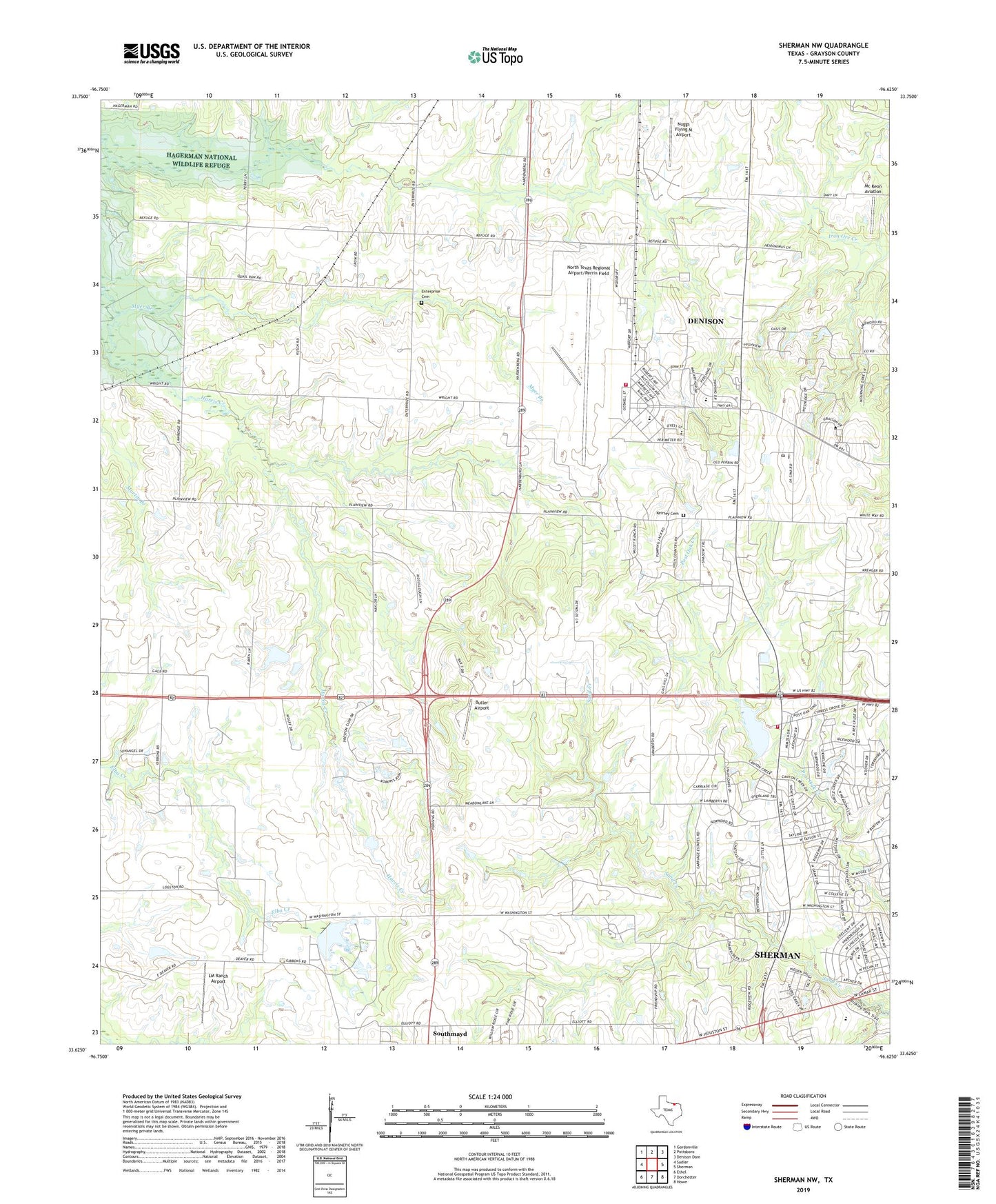
Sherman NW Texas US Topo Map
Couldn't load pickup availability
2019 topographic map quadrangle Sherman NW in the state of Texas. Scale: 1:24000. Based on the newly updated USGS 7.5' US Topo map series, this map is in the following counties: Grayson. The map contains contour data, water features, and other items you are used to seeing on USGS maps, but also has updated roads and other features. This is the next generation of topographic maps. Printed on high-quality waterproof paper with UV fade-resistant inks.
Quads adjacent to this one:
West: Sadler
Northwest: Gordonville
North: Pottsboro
Northeast: Denison Dam
East: Sherman
Southeast: Howe
South: Dorchester
Southwest: Ethel
Contains the following named places: Butler Airport, Church of Christ, Corner Stone Baptist Church, Crow Hill Trail, Enterprise Cemetery, Fairview Park, Fairview Park Trail, Forest Woodmen Circle Cemetery, Friendship Cemetery, Friendship Church, Grayson County, Grayson County Farm Cemetery, Hagerman Church, Harvest Time Assembly of God Church, Keirsey Cemetery, LM Ranch Airport, McKeon Aviation, Myer Branch, North Park Baptist Church, North Texas Regional Airport Fire Department, North Texas Regional Airport/Perrin Field, Nuggs Flying M Airport, Offutt Cemetery, Perrin Air Force Base, Perrin Air Force Station, Perrin Learning Center, Sherman Country Club Lake, Sherman Country Club Lake Dam, Sherman Fire Department Station 3 Pecan Grove, Sherman Oil Field, The Church of Jesus Christ of Latter Day Saints Church - Sherman, Wakefield Elementary School, Wakefield School, West Sherman Baptist Church, Woodman Circle Home, ZIP Code: 75092