MyTopo
Shiloh Texas US Topo Map
Couldn't load pickup availability
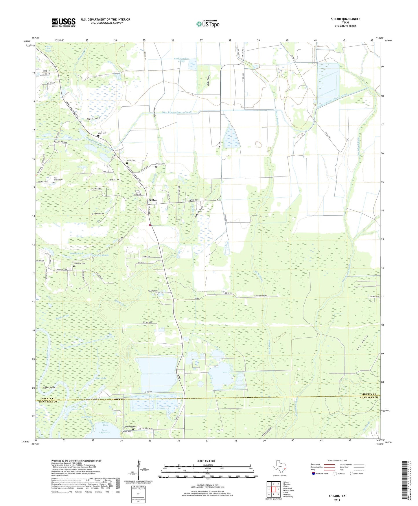
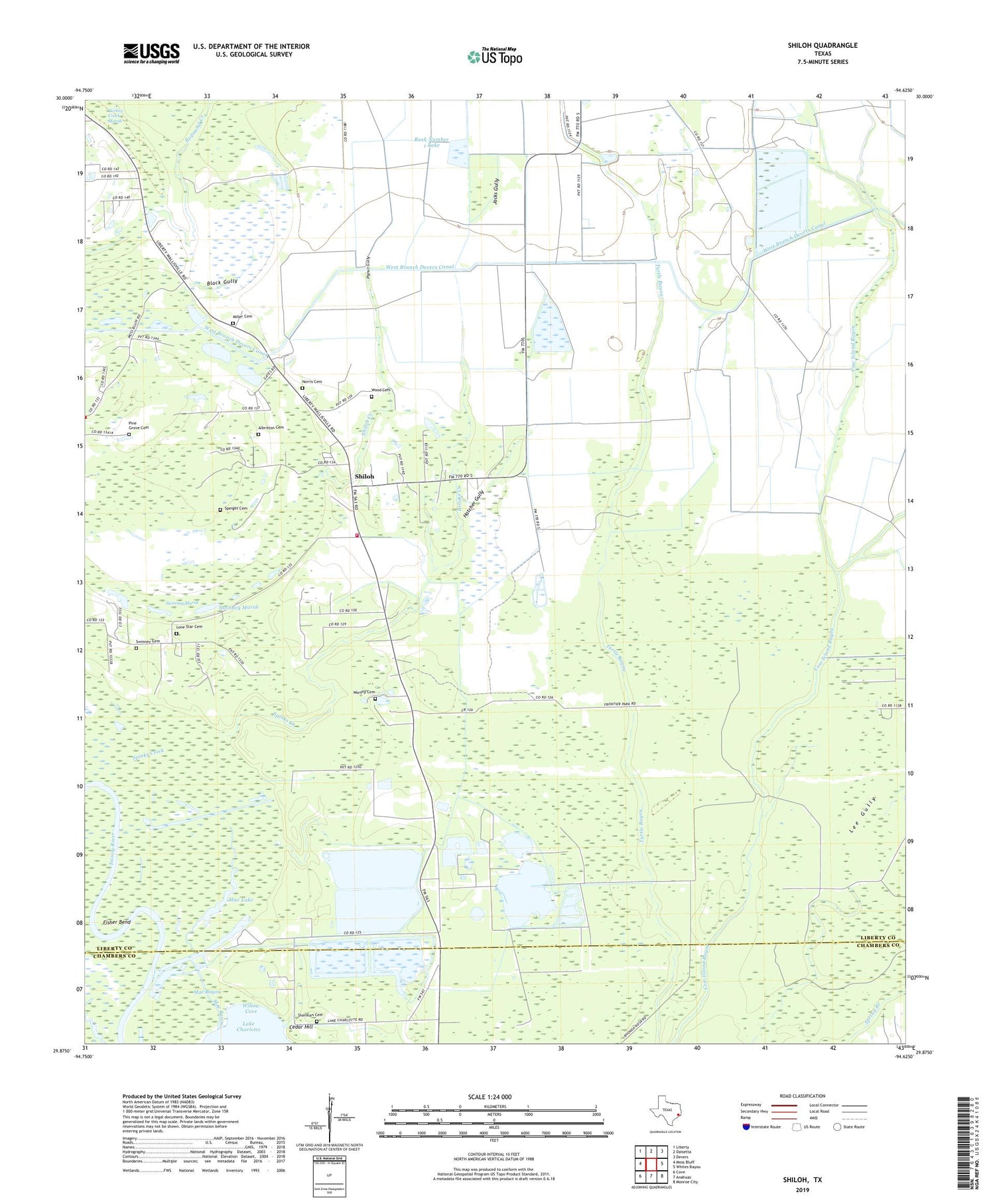
2019 topographic map quadrangle Shiloh in the state of Texas. Scale: 1:24000. Based on the newly updated USGS 7.5' US Topo map series, this map is in the following counties: Liberty, Chambers. The map contains contour data, water features, and other items you are used to seeing on USGS maps, but also has updated roads and other features. This is the next generation of topographic maps. Printed on high-quality waterproof paper with UV fade-resistant inks.
Quads adjacent to this one:
West: Moss Bluff
Northwest: Liberty
North: Daisetta
Northeast: Devers
East: Whites Bayou
Southeast: Monroe City
South: Anahuac
Southwest: Cove
Contains the following named places: Albritton Cemetery, Black Gully, Brooks Creek, Cedar Hill, Fisher Bend, Hatcher Gully, Jacks Gully, Lone Star Cemetery, Mac Bayou, Mac Lake, Miller Cemetery, Moss Bluff Volunteer Fire Department Station 2, Mount Zion School, Norris Cemetery, Pignut Gully, Pine Grove Cemetery, Rusk Number 1 Dam, Rusk Number 1 Lake, Saint Thomas Church, Sherman Cemetery, Shiloh, Shiloh Church, Shiloh Creek, Speight Cemetery, Spinks Creek, Swinney Cemetery, Swinney Marsh, Tivett, Turkey Creek Marsh, Willow Cove, Wood Cemetery, Worthy Cemetery