MyTopo
Devers Texas US Topo Map
Couldn't load pickup availability
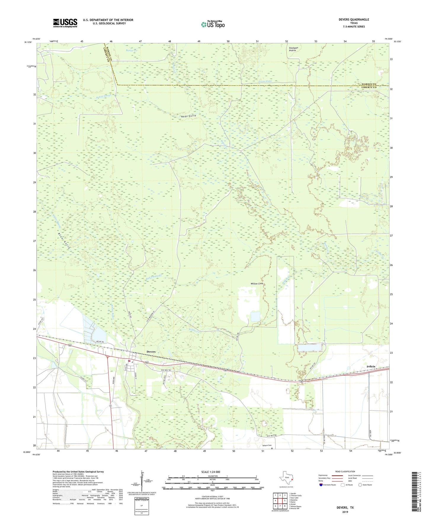
2022 topographic map quadrangle Devers in the state of Texas. Scale: 1:24000. Based on the newly updated USGS 7.5' US Topo map series, this map is in the following counties: Liberty, Hardin. The map contains contour data, water features, and other items you are used to seeing on USGS maps, but also has updated roads and other features. This is the next generation of topographic maps. Printed on high-quality waterproof paper with UV fade-resistant inks.
Quads adjacent to this one:
West: Daisetta
Northwest: Hardin
North: Thorson Gully
Northeast: Sour Lake
East: Nome
Southeast: Winnie NW
South: Whites Bayou
Southwest: Shiloh
This map covers the same area as the classic USGS quad with code o30094a5.
Contains the following named places: Batiste Creek, Blau Gully, Boyt Pre - Kindergarten School, Bull Tongue Creek, City of Devers, Daisetta Division, Devers, Devers City Hall, Devers Elementary School, Devers Post Office, Devers Volunteer Fire Department, Devers Woods, Felicia, Hogpen Crossing, Jerome Slough, Keys Camp, KHYS-FM (Port Arthur), KSHN-FM (Liberty), KWIC-FM (Beaumont), KYKR-FM (Port Arthur), Meche Reservoir, Neds Gully, Sahara Cemetery, Stephen Meche Dam, Stockpen Prairie, Taylor Camp, West End Slough, Willow Cove, ZIP Code: 77533